Swansea, Glamorgan
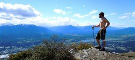
What if you want to take a taste of the whole UK during a small journey? Swansea’s tranquil land is suitable for hiking in small-organized groups or with your own company.
Home  > MOUNTAIN SPORTS  > Extreme Hiking / Hiking  > Xirovouni Mountain Trail, Euboea
With easy and fast access from Athens by car, train or bus over Chalkida bridge, connecting the Greek mainland with Euboea’s island, along with the combination of fantastic mountainous landscapes with incredible white sand beaches, Euboea is an ideal destination for all kinds of adventure holidays, all year round.
Steni is a mountainous village, situated on the foothills of Dirfis Mountain, stands at 1745 m/5725 ft high. Once you enter the village, you will be overwhelmed by the smell of the fresh mountain air and the sounds of the running water.
One of the best ways to discover the area is to arrange an organized hiking tour, introducing you to the wild side of Euboea. One of the many fantastic routes you can choose from is to hike the Xirovouni mountain trail. Xirovouni’s top elevation is at 1453 m/4767 ft high, being considered as part of Dirfi’s mountain range.
You will hike through dense forest, covered with pine and oak trees as well as water streams with crystal clear water. As soon as you hike up higher and higher, terrain becomes rocky with many holes among the rocks. This alpine setting makes the hike more challenging. However, once you reach the top of the mountain, you will have the opportunity to admire breathtaking views of the surrounding summits and if weather is clear, you can view the Aegean sea and spot the island of Skyros on the background.
The trail is 7.9 mi/11.2 km long, lasting about seven hours hiking and is suitable for hikers of any skill level. The best time to hike Xirovouni Mountain is during spring and autumn, where you can enjoy the blooming nature and the warm Mediterranean climate. Let the experienced guides lead you safely on a mountain adventure and allow yourself to enjoy a unique hike in the beautiful alpine mountains of Euboea.

What if you want to take a taste of the whole UK during a small journey? Swansea’s tranquil land is suitable for hiking in small-organized groups or with your own company.
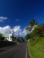
Honokaa town is located in the Hamakua Coast, at 40 mi/64 km in the north of Hilo. The area is a historic district of Big Island in Hawaii because the town's economy was once based on sugar production from the Hamakua Sugar Company, until 1994.
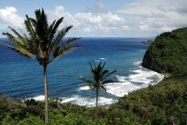
Pololu Valley is the Northernmost valley, forming the East coast of the Kohala Mountain after Waipio Valley. The valley goes at 420 ft/128 m downwards and it ends at a beautiful beach with black sand.
Honokaa town is located in the Hamakua Coast, at 40 mi/64 km in the north of Hilo. The area is a historic district of Big Island in Hawaii because the town's economy was once based on sugar production from the Hamakua Sugar Company, until 1994.
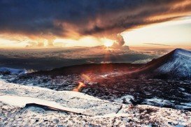
Mauna Kea is one of the five active volcanoes on the island of Hawaii, at 35 mi/56 km in the West of Hilo Town. Its peak is the highest point in the state, standing at 13803 ft/4207 m above the sea level.
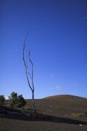
Volcano National park is located at 30 mi/48 km in the southwest of Hilo Town in Hawaii. The park was established in 1916 and is a combination of unique ecosystems and diverse environments that range from the sea to the summit of the world's biggest volcano, Mauna Loa, as well as Kilauea witch is the world's most active volcano.
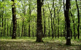
The plateau of Folois nestles at the southwest foot of Mount Erymanthus, in Hleia. Its name derived from mythology and the king of the Centaurs, Follo, friend of Hercules. Folois forest, with the unrivaled natural beauty, is one of the largest oak forests in Europe.
Nea Artaki is located on the island of Euboea, in Greece. It's at 10 km/6 mi away from Chalkida, the capital city and the main port of Euboea. In recent years, the expansion of the two cities has connected Nea Artaki with the urban of Chalkida. The last one, it's known for the castle of Karababa, in the hill of Kanitho and the bridge of Evripos.
Kalavrita is a small picturesque town, located in Achaia. It is a popular tourist destination that attracts visitors both winter and summer months. The well-known ski resort, the amazing Cave of the Lakes and the beautiful pine forests are only some of the challenges in the region.
Loutsa (aka Artemis) is situated in east Attica, Greece and is a suburban town about 25 km/16 mi east of Athens, north of Lavrio, northeast of the Eleftherios Venizelos International Airport and south of Rafina. Artemis or Artemida is located on a plain with some forested mountains to the northwest and a deforested rocky mountain to the south, in a farm setting full of grasslands, some rocks and groves, pine forests and farmlands.
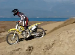
It's a beautiful day, the sunshine is lighting your face. Suddenly, you hear a noise and a big black cloud is coming close to you. Don't be afraid, it's just a motocross show. It's a dirty game full of adrenaline. The wild instincts are in the air. The passion for this fast angel can clear your mind.
Chelmos is a mountain range in Achaea, in the Peloponnese region, in southern Greece. It's also known as Aroania and it's the highest mountain of Achaea (2355 m/7726 ft). The largest town near this beautiful mountain, is Kalavryta. The fresh air and the wild beauty of the pine forests give this place a mystery that makes you not to wanna leave the place. The grasslands and the barren rock protect this treasure. Let the butterflies lead you to the Cave of the Lakes, where you can find strange rock formations and beautiful lakes.
Kamari is a small village in the municipality of Liladia, on Euboea island, in Greece. It's located at 23 km/14.3 mi in the east of Chalkida, the capital city of Euboea. The stream of Atheros and Pirgaki mountain are the guards of this peaceful village.
Mount Parnitha is located in the North Athens regional unit and is the highest mountain range of Attica. Much of this densely forested mountain is designated a national park, and is a protected habitat for wild birds.