Black Butte, Mount Shasta
Mount Shasta is located in northern California, east of Interstate 5 along SR89, between Mount Shasta city and McCloud city, California, USA.
Home > MOUNTAIN SPORTS > Backpacking / Trekking > Kennedy Meadows, Sonora
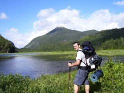
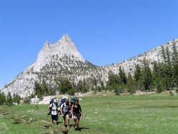
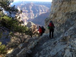
Trails are spread everywhere across the mountains. There is something for everyone in the Sonora Pass region, as there are all kind of trails, easy, intermediate and high elevation and also long day adventures. One of the best trails to go backpacking is Kennedy Meadows to Relief Reservoir.
It is a one way, 3 mi/4.8 km, moderate trail with elevation gain of 1000 ft/304.8 m. This trail takes you to the shores of Relief Reservoir. Begin your adventure at Kennedy Meadow. The first mile is an easy stroll, going through the meadow, where some episodes of “Little House on the Prairie”, a television creation by Michael Landon, were filmed.
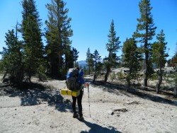
After crossing a bridge, you begin a steep climb on a wide trail, carved out of the mountainside, right after the Relief Dam was being constructed in the early 1900’s. There is another bridge and steep climb, taking you past an old P G and E building. Not far away you find the area around the dam.
While continuing on the trail along the hillside high above the reservoir, you turn onto a use trail that leads to the dam. You can camp near the Lake or the Meadow.
Mount Shasta is located in northern California, east of Interstate 5 along SR89, between Mount Shasta city and McCloud city, California, USA.
The plateau of Folois nestles at the southwest foot of Mount Erymanthus, in Hleia. Its name derived from mythology and the king of the Centaurs, Follo, friend of Hercules. Folois forest, with the unrivaled natural beauty, is one of the largest oak forests in Europe.
Bear Valley is a ski area located near Angels Camp, on highway 4, between Lake Tahoe and Yosemite, approximately 3 hours southeast of Sacramento, California, USA.
Sonora Pass is located near Pinecrest, Tuolumne County, California, USA. It is off of Highway about 60 mi/96.5 km east of Sonora.
Metsovo, one of Greece's best known resorts, boasts some of the most spectacular scenery in the Balkan Peninsula, offering a backdrop of forested hills, rivers and springs surrounded by a national park and protected areas.
Bali is a province in Indonesia with a few neighboring islands including the Isle of Bali. The island of Bali lies at about 8 degrees/ 0.13 radians on the south of equator and at 3.2 km/1.9 mi from Java. It is surrounded by coral reefs with white sand beaches on the south and black sand beaches on the north and the west of the island.
Sonora Pass is located near Pinecrest, Tuolumne County, California, USA. It is off of Highway about 60 mi/96.5 km east of Sonora.
Soda Springs ski resort is located near Soda Springs, Nevada County, California, USA. Soda Springs ski resort is just off of Highway 80, near the Donner Summit.
Yosemite National Park is located near Mariposa, California, USA.
Sonora Pass is located near Pinecrest, Tuolumne County, California, USA. It is off of Highway about 60 mi/96.5 km east of Sonora.
Bear Valley is a ski area located near Angels Camp, on highway 4, between Lake Tahoe and Yosemite, approximately 3 hrs southeast of Sacramento, California, USA.
Donner Ski Ranch is a resort located on Donner Summit, in the Tahoe National Forest, Nevada County, California, USA. The area has been used for skiing since 1939.
Sonora Pass is located near Pinecrest, Tuolumne County, California, USA. It is off of Highway about 60 mi/96.5 km east of Sonora.