
Ladhar Bheinn, Knoydart
Knoydart known as the Rough Bounds lies between the lochs Nevis and Hourn in Lochaber peninsula.
Home  > MOUNTAIN SPORTS  > Extreme Hiking / Hiking  > Mount Eddy, Mount Shasta City
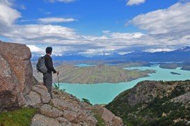
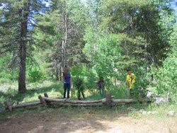
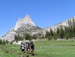
Mount Shasta is inside Shasta – Trinity National Forest. Mount Shasta is the second highest volcano in the Cascade Range. On the west of Mount Shasta, Mount Eddy dominates the mountain range across the valley. It is a conifer forest with granite rocks, alpine lakes and many small streams, offering a different hiking experience.
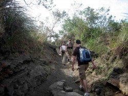
Hike trails are divided to short (15-45 minutes) and medium (1-2 hours) trails. Short trails are Box Canyon Dam and Trail, a ¾ mi/1.2 km trail, offering a wonderful view of the canyon and Castle Shore Trail, an easy ½ hour, 5 mi/8 km trail, with 6400 ft/1952 m elevation.
A medium hike is Castle Lake Trail, a 2-3 hour, 3 mi/4.8 km trail, with 6000 to 6200 ft/1823 to 1890 m elevation, which is strenuous at first and then turns into a moderate, rocky path. Best time to hike is early June to October. Mountains create their own weather, so better be prepared and informed about the weather, before you start your hiking adventure.
Knoydart known as the Rough Bounds lies between the lochs Nevis and Hourn in Lochaber peninsula.
Volcano National park is located at 30 mi/48 km in the southwest of Hilo Town in Hawaii. The park was established in 1916 and is a combination of unique ecosystems and diverse environments that range from the sea to the summit of the world's biggest volcano, Mauna Loa, as well as Kilauea which is the world's most active volcano.
Bear Valley is a ski area located near Angels Camp, on highway 4, between Lake Tahoe and Yosemite, approximately 3 hours southeast of Sacramento, California, USA.
Amathole is an area with stunning scenic beauty and rich in history. Located in the Eastern Cape, it has diverse landscapes ranging from mountains, rivers, beaches, forests and estuaries. Hidden gems include the majestic rainforest, which is protected to date. Indigenous forest and breathtaking waterfalls are a must see in this region.
In the North side of Kealakekua Bay, close to HI-11/ Hawaii Belt Rd, lies the monument of British explorer Captain Cook, who was killed in 1779. The road that leads to the monument is accessible by foot only.
Sonora Pass is located near Pinecrest, Tuolumne County, California, USA. It is off of Highway about 60 mi/96.5 km east of Sonora.
Boreal Mountain Ski Resort is a ski area located in Soda Springs, near Lake Tahoe, California, USA. Nearest city is Truckee and the resort is on Highway 80, in the west of the city.
Mount Shasta is located in northern California, east of Interstate 5 along SR89, between Mount Shasta city and McCloud city, California, USA.
Heavenly Mountain Resort is located near the city of South Lake Tahoe, on the California-Nevada border, El Dorado County, California, USA.
South Lake Tahoe is located on the California–Nevada border, El Dorado County, California, USA.
The ''Merrell Down & Dirty Obstacles'' race, presented by Subaru, takes place on November 2nd 2014 in Sacramento. This big one-day event is addressed to everybody and tests ones limits and endurance.
Dodge Ridge ski resort is located near Pinecrest, Tuolumne County, California, USA. It is off of Highway about 50 mi/80.5 km east of Sonora.
Sonora Pass is located near Pinecrest, Tuolumne County, California, USA. It is off of Highway about 60 mi/96.5 km east of Sonora.