ADD COMMENT
Lake Tahoe, South Lake Tahoe
/
California USA
South Lake Tahoe is located on the California–Nevada border, El Dorado County, California, USA.
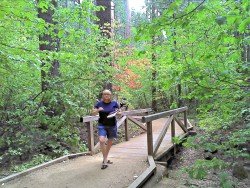
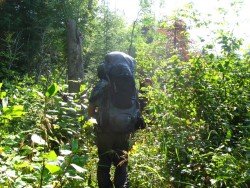
Mount Shasta is inside Shasta – Trinity National Forest and the second highest volcano in the Cascade Range. On the west of Mount Shasta, Mount Eddy dominates the mountain range across the valley. Between Mount Shasta and Mount Eddy lies the magnificent 9 mi/14.5 km Sisson – Callahan National Recreational Trail, which is ideal for hiking.
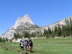
It is an area of breathtaking alpine lakes, rugged peaks, rushing steams and emerald green meadows. Ιts position offers spectacular Mountain View, especially the view of Castle Crags to the south and Trinity Alps to the west, as seen from Deadfall Summit.
The trail has a 8.020 ft/2.444 m elevation and crosses through Deadfall Summit, right up from Deadfall Lakes. If you hike on spring or early summer, it is possible to find snow at the summit, but still be able to enjoy the intoxicating smell of azaleas, blooming down along the North Fork of Sacramento River.
During your hike you will see an amazing variety of conifer species. Water is plenty and you will find campsites at frequent intervals next to the trail. The Sisson – Callahan National Recreational Trail is one of the 47 National Recreational Trails in the National Forest of California.
Route to trailheads starts from Deadfall Lakes and North fork of the Sacramento River.
South Lake Tahoe is located on the California–Nevada border, El Dorado County, California, USA.
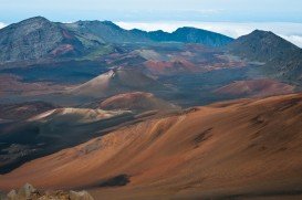
Volcano National park is located at 30 mi/48 km in the southwest of Hilo Town in Hawaii. The park was established in 1916 and is a combination of unique ecosystems and diverse environments that range from the sea to the summit of the world's biggest volcano, Mauna Loa, as well as Kilauea witch is the world's most active volcano.
Wenatchee is the largest city of Chelan County, located in North Central Washington and lies on the west side of the Columbia River. The city is also known as the Apple Capital of the world, due to the valley's apple cultivations.
Bear Valley is a ski area located near Angels Camp, on highway 4, between Lake Tahoe and Yosemite, approximately 3 hrs southeast of Sacramento, California, USA.
Wenatchee is the largest city of Chelan County, located in North Central Washington and lies on the west side of the Columbia River. The city is also known as the Apple Capital of the world, due to the valley's apple cultivations.
Wenatchee is the largest city of Chelan County, located in North Central Washington and lies on the west side of the Columbia River. The city is also known as the Apple Capital of the world, due to the valley's apple cultivations.
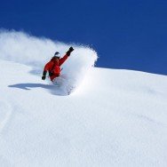
Northstar California is a ski resort, located near Truckee, California, USA. It is a very big ski resort, covering 3170 skiable acres/12.83 km².
Badger Pass Ski Area is a small ski area which is located in Yosemite National Park, near Mariposa, California, USA.
Bear Valley is a ski area located near Angels Camp, on highway 4, between Lake Tahoe and Yosemite, approximately 3 hours southeast of Sacramento, California, USA.

Sonora Pass is located near Pinecrest, Tuolumne County, California, USA. It is off of Highway about 60 mi/96.5 km east of Sonora.
Bear Valley is a ski area located near Angels Camp, on highway 4, between Lake Tahoe and Yosemite, approximately 3 hours southeast of Sacramento, California, USA.
Sonora Pass is located near Pinecrest, Tuolumne County, California, USA. It is off of Highway about 60 mi/96.5 km east of Sonora.
Sonora Pass is located near Pinecrest, Tuolumne County, California, USA. It is off of Highway about 60 mi/96.5 km east of Sonora.
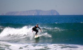
Garth’s Reef is located near Crescent City, at short distance to the south, in Del Norte County, California, USA.