

ADD COMMENT
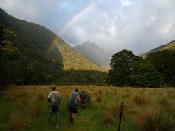
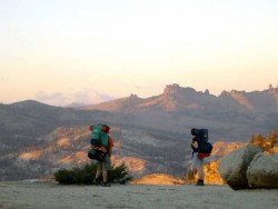
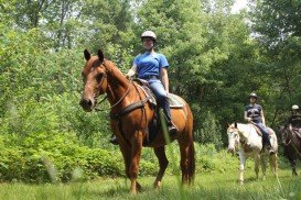
Kepler Track, Te Anau
/
Southland New Zealand
Te Anau is a small town, situated in Fiordland region, in the South Island of New Zealand.
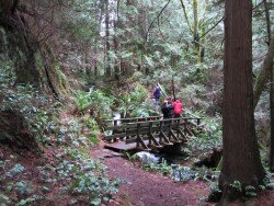
Trails are spread everywhere across the mountains. There is something for everyone in the Sonora Pass region, as there are all kind of trails, easy, intermediate and high elevation and also long day adventures. Eagle Meadow is located east of Highway 108, approximately half an hour away.
There are three easy, natural, wonder trails, perfect for backpacking. The first one is Columns of the Giants. It is a one way, quarter mile (0.25 mi/0.40 km) trail located next to the Pigeon Flat Campground, where you can camp and which is approximately 1.5 mi/2.4 km east of Dardanelles Resort.
It is an easy trail, that takes you to an unusual geologic formation with magnificent views of basalt columns, reminding of the Devil’s Postpile. The second one is Trail of the Gargoyles. It is a 1.5 mi/2.4 km, one way trail, taking you to some strangely shaped, volcanic, rock formations, called Trail of the Gargoyles.
To reach this trail, drive east from Strawberry to the Herring Creek Road turnoff, on the right. When reaching the overlook up the trail, you get a spectacular view of a canyon and mountains. The third trail is the Trail of the Ancient Dwarfs.
It is a one way, 5 mi/8 km hike, leading you through a forest of ancient dwarf trees. A visit to this trail is best combined with a view of the ancient Bennett Jupiter, because they are both near Eagle Meadow.
Te Anau is a small town, situated in Fiordland region, in the South Island of New Zealand.
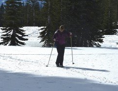
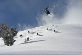
Bear Valley is a ski area located near Angels Camp, on highway 4, between Lake Tahoe and Yosemite, approximately 3 hours southeast of Sacramento, California, USA.
Hell's Gate is located in the South of Lake Naivasha and at about 90 km/55 mi in the northwest of Nairobi City. It covers an area of 68 km²/26.25 mi² and is at 1900 m/6233 ft above sea level. Some of the highlights are the Fischer's tower, Central tower and Hell's Gate gorge. Although there is a wide variety of wildlife, it is famous for a variety of bird species including vultures, verreaux's eagles, swifts and augur buzzards.
Ilha Grande is the biggest and most well known island of the Green Bay at about 150 km/93 mi in the west-side of the State of Rio de Janeiro. Rio de Janeiro, commonly known as Rio, is the capital city of the Rio de Janeiro State, the second largest city of Brazil and the third largest metropolitan area in South America. Since July 2012, part of the city has been designated by UNESCO as a World Heritage Site in the category of ''cultural landscape''.
Sonora Pass is located near Pinecrest, Tuolumne County, California, USA. It is off of Highway about 60 mi/96.5 km east of Sonora.
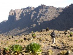
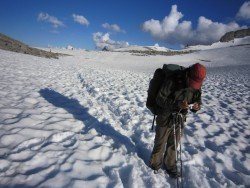
Located almost at 150 km/93 mi from Nairobi City, Mt. Kenya is located just south of the equator, offering three climbing routes, namely Naro-Moru, Sirimon and Chogoria. Mt. Kenya has magnificent cliffs and glaciers that protect the highest peaks. Highest peaks here are Batian at 5199 m/17057 ft, Nelion at 5188 m/17021 ft and Point Lenana at 4985 m/16355 ft.
Mount Shasta is located in northern California, east of Interstate 5 along SR89, between Mount Shasta city and McCloud city, California, USA.
Sonora Pass is located near Pinecrest, Tuolumne County, California, USA. It is off of Highway about 60 mi/96.5 km east of Sonora.
Sonora Pass is located near Pinecrest, Tuolumne County, California, USA. It is off of Highway about 60 mi/96.5 km east of Sonora.
Sonora Pass is located near Pinecrest, Tuolumne County, California, USA. It is off of Highway about 60 mi/96.5 km east of Sonora.
Bear Valley is a ski area located near Angels Camp, on highway 4, between Lake Tahoe and Yosemite, approximately 3 hours southeast of Sacramento, California, USA.
Squaw Valley Ski Resort is located in Olympic Valley, California, USA. It is one of the largest ski areas in the US after Heavenly and was the site of the 1960 Winter Olympics.
Mammoth Mountain is located in California’s eastern Sierra, at 100 mi/161 km south of Nevada State line and 50 minutes from the Eastern Gate of Yosemite National Park.
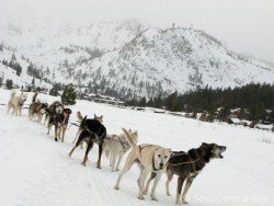
Squaw Valley Ski Resort is located in Olympic Valley, California, USA. It is one of the largest ski areas in the US after Heavenly and was the site of the 1960 Winter Olympics.


