
Sandbridge Beach, Outer Banks
Sandbridge is a coastal community of Virginia Beach, situated along the coastline on the Currituck Banks Peninsula at the northern end of the Outer Banks.
Home  > WATER SPORTS  > Kayaking  > Klamath River, Crescent City
Along its way, it gets contributions on its volume from the rivers Scott, Cal Salmon and Trinity. Klamath River is one of the biggest and longest rivers. It is named after the Chinook word for swiftness. Along its sides on the Klamath River valley, many Indian tribes (including the Shasta, Yurok and Karok) made their home, because of the plentiful Salmon and steel-head.
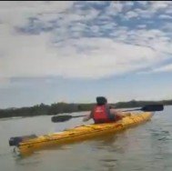
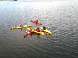
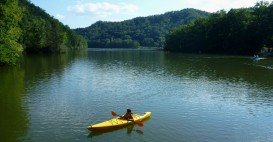
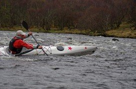
Due to the climate changes, geology of the scenery and the wildlife, it changes drastically from the headwaters to the lower stretches of the river. Klamath River, thanks to its length and its scenery, is a very popular spot for kayaking. Kayaking in Klamath River varies for experienced and non experienced kayakers.
Trips are considered remote away from the highway. The trips are known for their scenic beauty and abundance of the wildlife. You can observe on these trips fish, deer, eagles, foxes, herons, bears, coyote, osprey and perhaps even Bigfoot!
For a better trip, kayakers should wear tennis shoes or sandals, bring plenty of water and wear sunscreen and a hat. Long shorts and long sleeve river shirts are required, so to avoid sunburns on inner tights. Kayakers should also bring a watch and a cell phone.
Sandbridge is a coastal community of Virginia Beach, situated along the coastline on the Currituck Banks Peninsula at the northern end of the Outer Banks.
Pasir Ris in Malay means "beach bolt-rope", simply implying a narrow beach. It is geographically divided into three regions, namely Loyang (East) Central and Elias (West). Due to its proximity to the sea, it has several recreation facilities and has a keenly preserved mangrove forest with boardwalks to allow visitors get closer to the inhabitants. The full length of the park is around 6.6 km/4.1 mi long.
Torres del Paine is located in Southern Patagonia and is one of the numerous and spectacular national parks in Chile. It was created in 1959 and UNESCO has listed the location as a Biosphere Reserve since 1978. This place is a wonderland for nature enthusiasts from all over the world.
Zadar is a city with rich cultural heritage, located in Pag Island, Croatia on the Adriatic Sea. It is the center of Zadar County and the wider northern Dalmatian region. Pag is the fifth-largest island of the Croatian coast and the one with the longest coastline.
Torres del Paine is located in Southern Patagonia and is one of the numerous and spectacular national parks in Chile. It was created in 1959 and UNESCO has listed the location as a Biosphere Reserve since 1978. This place is a wonderland for nature enthusiasts from all over the world.
Big Lagoon is located at 7 mi/11.3 km north of Trinidad, Humboldt County, California, USA.
Mount Shasta is located in northern California, east of Interstate 5 along SR89, between Mount Shasta city and McCloud city, California, USA.
Garth’s Reef is located near Crescent City, at short distance to the south, in Del Norte County, California, USA.
Mount Shasta is located in northern California, east of Interstate 5 along SR89, between Mount Shasta city and McCloud city, California, USA.
Big Lagoon is located at 7 mi/11.3 km north of Trinidad, Humboldt County, California, USA.