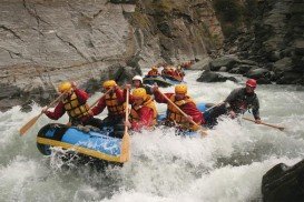
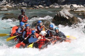
Kawarau River, Queenstown
Queenstown is considered by many as the capital of extreme sports. It is situated in Otago region, in the South Island, New Zealand, and is surrounded by Lake Wakatipu and the awe-inspiring Southern Alps.
Home  > WATER SPORTS  > Rafting  > Olifants River, Kruger National Park
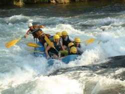
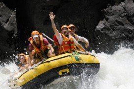
Olifants River, crossing the Kruger National Park, is a high-volume river and offers an amazing rafting experience. Rafting here is open to both the novice and experienced rafter. The river passes through a wilderness area, surrounded by the magnificent Olifants Gorge and has low gradients. Rapids graded between 1- 3 but sometimes it gets to grade 4, depending on water levels.
Paddlers get to swing smoothly into the current, then a gigantic wave that seems silent, then changes into wave trains, standing waves, pour-over and holes resulting in an incredible rafting experience!! The paddling area covers a distance of 12 km/7.4 mi long with exciting and challenging rapids. Level fitness needs to be taken into account and the minimum age limit is 16 years-old with a minimum pax of 4.

Queenstown is considered by many as the capital of extreme sports. It is situated in Otago region, in the South Island, New Zealand, and is surrounded by Lake Wakatipu and the awe-inspiring Southern Alps.
Marrakesh or Marrakech is the fourth largest city in Morocco and one of the busiest cities in whole Africa. It lies close to the foothills of the impressive Atlas Mountains and a few hours away from the famous Sahara Desert. The climate here is classified as hot semi-arid climate, with mild humid winters and dry summers. Marrakesh is well-known for its hospitality, markets, souks and cuisine.
Queenstown is considered by many as the capital of extreme sports. It is situated in Otago region, in the South Island, New Zealand, and is surrounded by Lake Wakatipu and the awe-inspiring Southern Alps.
Zagorochoria is a network of 46 beautiful mountainous villages, located in the county of Ioannina in northwestern Greece and is a place of outstanding natural beauty. The villages are scattered at the foothills of Pindos mountain range and the whole area is extremely rugged with steep canyons, dense forests, incredible biodiversity, fresh water streams and rivers and alpine lakes.
Saint-Crepin is situated in the Hautes-Alpes department (Provence-Alpes, Cote d'Azur region) in the south-east of France at 45 km/27 mi from Gap, the departmental capital. The village is located near the Durance River, ideal spot for whitewater kayaking or canoeing.
False Bay is a body of water characterized by Cape Hangklip and Cape Peninsula, located in the southwest of South Africa. The bay is 30 km/18.7 mi wide, offering a Mediterranean climate with warm, dry summers and wet damp winters. The east and western shores of the bay are rocky and mountainous with visible peaks rising from the waters, while the northern side comprises a long, curving beach.
Limpopo is the northernmost province of South Africa and named after the second biggest river in Africa, River Limpopo. It borders with Botswana to the West, Zimbabwe to the North and Mozambique to the East. Characterized by primeval indigenous forests, majestic mountains and unspoilt natural setting, it is an adventure seeker's haven.
The Bushveld is a sub-tropical woodland ecoregion of Southern Africa, encompassing most of Limpopo Province and a small part of the North West Province of South Africa, the Central and North-East Districts of Botswana and the Matabeleland South and part of the Matabeleland North provinces of Zimbabwe.
Limpopo is the northernmost province of South Africa and named after the second biggest river in Africa, River Limpopo. It borders with Botswana to the West, Zimbabwe to the North and Mozambique to the East. Characterized by primeval indigenous forests, majestic mountains and unspoilt natural setting, it is an adventure seeker's haven.