
ADD COMMENT
Rogue River, Grants Pass
/
Oregon USA
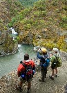
Rogue River is situated in southwestern Oregon, near the city of Grants Pass.
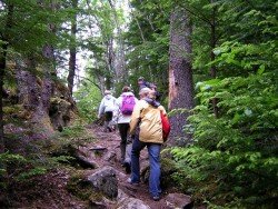
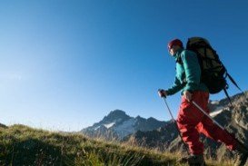
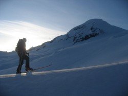
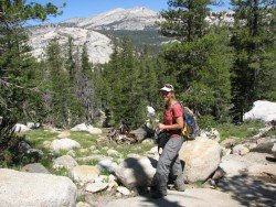
Hiking trails are spread everywhere across the mountains. There is something for everyone in the Sonora Pass region, as there are all kind of trails, easy, intermediate and high elevation and also long day adventures. One of the best trails to hike is Iceberg Meadow to Boulder Creek.
It is a 2.5 mi/4 km, moderate trail with elevation gain of 500 ft/152.4 m. It is a shaded, forest hike, taking you from Iceberg Meadow up the Clark Fork. It is a kind of easy hike, having only a moderate elevation gain. In the biggest part of the hike you are near the Clark Fork, giving you the opportunity to stop and fish.
Watch out for hawks, nesting in the trees. After walking 2.5 mi/4 km of the hike, you get close the junction to Boulder Creek trail. Boulder Lake is up the trail about 1.5 mi/2.4 km, but is a steep 1200 ft/365.8 m climb and the trail is not so good maintained. While continuing for about 7.5 mi/12 km up the Clark Fork Trail, you reach the top of Saint Marie’s Pass.
Rogue River is situated in southwestern Oregon, near the city of Grants Pass.
Kahului is located in Maui Island on Hawaii and is the largest city of the Island. It is considered to be a shopping destination because there are several major stores and malls.
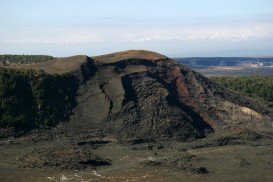
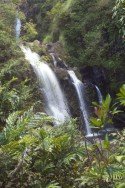
Volcano National park is located at 30 mi/48 km in the southwest of Hilo Town in Hawaii. The park was established in 1916 and is a combination of unique ecosystems and diverse environments that range from the sea to the summit of the world's biggest volcano, Mauna Loa, as well as Kilauea which is the world's most active volcano.
Meridian, the sixth largest city of Mississippi, except of hosting numerous cultural events, offers great opportunities to visitors for recreation all year long. It contains many parks with tennis courts, softball fields, swimming pools etc. Visitors can also experience water skiing, hiking and camping at Bonita Lakes area and Okatibbee Lake.
Kirkwood Mountain Resort is a year round resort in Kirkwood, south of Lake Tahoe, in El Dorado County, California, USA. Kirkwood is at 33 mi/53 km south of South Lake Tahoe, on State Route 88 and it is surrounded by El Dorado National Forest.
Kahului is located in Maui Island on Hawaii and is the largest city of the Island. It is considered to be a shopping destination because there are several major stores and malls.

Mammoth Lakes is located near Mammoth Mountain, in California’s eastern Sierra about 100 mi/161 km south of Nevada State Line, 9 mi/14.5 km northwest of Mount Morrison, at an elevation of 7880 ft/2402 m, Mono County, California, USA.
Mount Shasta is located in northern California, east of Interstate 5 along SR89, between Mount Shasta city and McCloud city, California, USA.
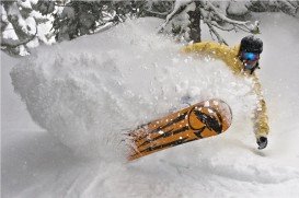
Sonora Pass is located near Pinecrest, Tuolumne County, California, USA. It is off of Highway about 60 mi/96.5 km east of Sonora.
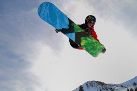
Squaw Valley Ski Resort is located in Olympic Valley, California, USA. It is one of the largest ski areas in the US after Heavenly and was the site of the 1960 Winter Olympics.
Mammoth Mountain is located in California’s eastern Sierra, at 100 mi/161 km south of Nevada State line and 50 minutes from the Eastern Gate of Yosemite National Park.
Yosemite National Park is located near Mariposa, California, USA.
Badger Pass Ski Area is a small ski area which is located in Yosemite National Park, near Mariposa, California, USA.
Bear Valley is a ski area located near Angels Camp, on highway 4, between Lake Tahoe and Yosemite, approximately 3 hours southeast of Sacramento, California, USA.


