Rafting in Padas River, Kota Kinabalu,
Sabah Malaysia
Distance :
23km/14.3mi
Rapid Grade :
Class III-IV
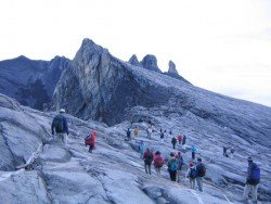
Famous due to its proximity with tropical islands, lush forests and Mount Kinabalu, Kota Kinabalu is the capital of the state of Sabah located in Borneo. It is located on the west coast of Sabah within the West coast Division. Formerly known as Jesselton, it enjoys a tropical rainforest climate and lies by the coast, overlooking at the South China Sea and bordered by the Crocker range which is home to Mount Kinabalu.
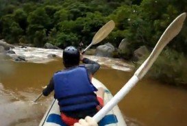
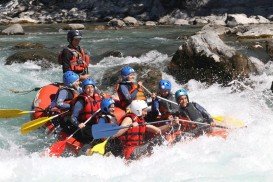
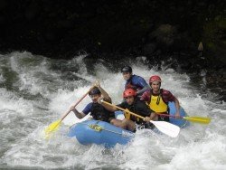
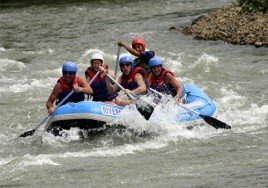
Padas River is located at the most interior part of south-western part of Kota Kinabalu and can only be accessed by train. The Padas river flows through the amazing Padas Gorge and white water rafting the Padas promises a thrilling and adrenaline rush for both the novice and expert paddler. The rapids’ sweet names like “scoobydoo” “merry-go-round” might fool you but they sure will give you the chills and test your paddling skills to the maximum!!
The paddling covers a distance of 23 km/14.3 mi long with 7 exhilarating rapids graded between class III-IV. The rapids starting point is at a traditional village, called Pangi which is home to the local Murat tribe who were previously head hunters!! Safety is at top notch as there are guides who take you through this thrilling adventure. Minimum age requirement here is 12 years old with some level of fitness and advance booking is necessary.
Irkut River is a river situated in the Republic of Buryatiya and the Oblast of Irkutsk. The river is Angara’s left tributary. Irkut River freezes up in late October - mid November and stays in that condition until late April - early May.
Limpopo is the northernmost province of South Africa and named after the second biggest river in Africa, River Limpopo. It borders with Botswana to the West, Zimbabwe to the North and Mozambique to the East. Characterized by primeval indigenous forests, majestic mountains and unspoilt natural setting, it is an adventure seeker's haven.
Kuala Lumpur is a huge city with a number of district articles and a lot to offer. Literally meaning "muddy river" in Malay, it is the federal capital and the largest city in Malaysia, covering an area of 243 km²/94 mi² long. Located in the center of Selangor State, Kuala Lumpur enjoys a tropical rainforest climate which is warm and sunny with abundant rainfall, especially between October to March.
Saint-Crepin is situated in the Hautes-Alpes department (Provence-Alpes, Cote d'Azur region) in the south-east of France at 45 km/27 mi from Gap, the departmental capital. The village is located near the Durance River, ideal spot for whitewater kayaking or canoeing.
Queenstown is considered by many sportsmen as the capital of extreme sports and adventure activities. It is situated in Otago region, in the South Island, New Zealand.
Famous due to its proximity with tropical islands, lush forests and Mount Kinabalu, Kota Kinabalu is the capital of the state of Sabah located in Borneo. It is located on the west coast of Sabah within the West coast Division. Formerly known as Jesselton, it enjoys a tropical rainforest climate and lies by the coast, overlooking at the South China Sea and bordered by the Crocker range which is home to Mount Kinabalu.
Famous for its proximity with the tropical islands, lush forests and Mount Kinabalu, Kota Kinabalu is the capital of the state of Sabah located in Borneo. It is located on the west coast of Sabah within the West coast Division. Formerly known as Jesselton, it enjoys a tropical rainforest climate and lies by the coast overlooking the South China Sea and bordered by the Crocker range which is home to Mount Kinabalu.
Famous due to its proximity with tropical islands, lush forests and Mount Kinabalu, Kota Kinabalu is the capital of the state of Sabah located in Borneo. It is located on the west coast of Sabah within the West coast Division. Formerly known as Jesselton, it enjoys a tropical rainforest climate and lies by the coast, overlooking the South China Sea and bordered by the Crocker range which is home to Mount Kinabalu.
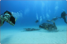
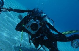
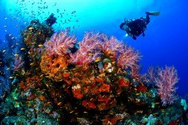
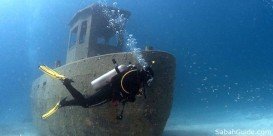
Pulau Tiga is located at 48 km/29.9 mi in the south of Kota Kinabalu and became well known due to the "Survivor" series, hosting the setting of "Survivor Borneo", the first American season of the show. Scuba diving in Pulau Tiga is open to all levels of divers and is a prime location for macro lovers and underwater photography. The spot is believed to have been formed by the eruption of several mud volcanoes and is at 100 m/328 ft above sea level.
Famous due to its proximity with tropical islands, lush forests and Mount Kinabalu, Kota Kinabalu is the capital of the state of Sabah located in Borneo. It is located on the west coast of Sabah within the West coast Division. Formerly known as Jesselton, it enjoys a tropical rainforest climate and lies by the coast, overlooking the South China Sea and bordered by the Crocker range which is home to Mount Kinabalu.
Famous for its proximity with tropical islands, lush forests and Mount Kinabalu, Kota Kinabalu is the capital of the state of Sabah located in Borneo. It is located on the west coast of Sabah within the West coast Division. Formerly known as Jesselton, it enjoys a tropical rainforest climate and lies by the coast, overlooking at the South China Sea and bordered by the Crocker range which is home to Mount Kinabalu.
Pulau Tiga is located at 48 km/30 mi in the south of Kota Kinabalu and became well known due to the "Survivor" series, hosting the setting of "Survivor Borneo", the first American season of the show. Scuba diving in Pulau Tiga is open to all levels of divers and is a prime location for macro lovers and underwater photography. The spot is believed to have been formed by the eruption of several mud volcanoes and is at 100 m/328 ft above sea level.
Pulau Tiga is located at 48 km/30 mi in the south of Kota Kinabalu and became well known due to the "Survivor" series, hosting the setting of "Survivor Borneo", the first American season of the show. Scuba diving in Pulau Tiga is open to all levels of divers and is a prime location for macro lovers and underwater photography. The spot is believed to have been formed by the eruption of several mud volcanoes and is at 100 m/328 ft above sea level.