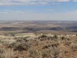
Queenstown, South Island
Queenstown is considered by many sportsmen as the capital of extreme sports and adventure activities. It is situated in Otago region, in the South Island, New Zealand.
Home  > MOUNTAIN SPORTS  > Extreme Hiking / Hiking  > Rogue River, Grants Pass
The river starts from Crater Lake, at 5320 ft/1621.5 m and goes all the way to the Pacific Ocean, at Gold Beach. The main trail, Lower Rogue River trail is 40 mi/64.37 km long, starts at Grave Creek and goes all the way to Illahe.
There are other courses that you can follow, like the Upper Rogue River trail and also some smaller ones. There are many sights to enjoy, while hiking and this is why the hiking trails at Rogue River have a high reputation. One can pass through river canyons, the  Union Creek Historic District, the Rogue Gorge and the Natural Bridge.
The hiking trails reach the shores of the river at some points and may elevate about 200 ft/60.96 m above the river at other points. In the winter time, hiking can be more challenging, as you may find several logs or bigger rocks in the middle of the trails, so more attention is needed. Several hiking schools near the area offer daily or up to 4-day excursions at the River, combining hiking and rafting. One thing is certain, hikers will find their “paradise” at Rogue River, because it is a place that combines natural beauty and adventure, as well as serenity and relaxation.
Queenstown is considered by many sportsmen as the capital of extreme sports and adventure activities. It is situated in Otago region, in the South Island, New Zealand.
Mt. Longonot is located in the South East of Lake Naivasha and at about 90 km/60 mi from Nairobi City. It stands at 2886 m/9468 ft with dormant volcanoes dominating the landscape. Mt. Longonot is lined with spectacular fissures and lava canyons. It is a strato-volcano with fairly steep slopes covered with volcanic ash.
Sonora Pass is located near Pinecrest, Tuolumne County, California, USA. It is off of Highway about 60 mi/96.5 km east of Sonora.
Torres del Paine is located in Southern Patagonia and is one of the numerous spectacular national parks in Chile. It was created in 1959 and UNESCO has listed the location as a Biosphere Reserve since 1978. This place is a wanderland for hikers from all over the world.
Bear Valley is a ski area located near Angels Camp, on highway 4, between Lake Tahoe and Yosemite, approximately 3 hours southeast of Sacramento, California, USA.
Pololu Valley is the Northernmost valley, forming the East coast of the Kohala Mountain after Waipio Valley. The valley goes at 420 ft/128 m downwards and it ends at a beautiful beach with black sand.
Mount Shasta is located in northern California, east of Interstate 5 along SR89, between Mount Shasta city and McCloud city, California, USA.
Crescent South Beach is located near Crescent City, Del Norte County, California, USA.
Mount Ashland is the tallest peak of Siskiyou Mountains, reaching at 7500 ft/2286 m. The spot is a majestic place to visit, if you are a fan of nature and sports.
Mount Shasta is located in northern California, east of Interstate 5 along SR89, between Mount Shasta city and McCloud city, California, USA.
Lake Earl is located in Talawa Dunes State Park, north of Crescent City, Del Norte County, California, USA.
