Breckenridge, Continental Divide Western Slope
Berthoud Pass is located between Idaho Springs and Winter Park and is one of the closest areas in Denver for whitewater rafting. It belongs to Boulder County and is just an hour away.
Home > WATER SPORTS > Rafting > Tana River, Sagana
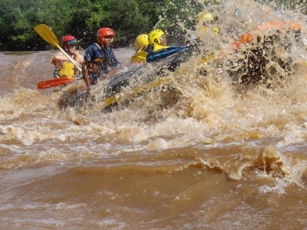
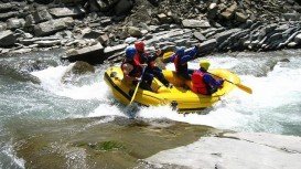
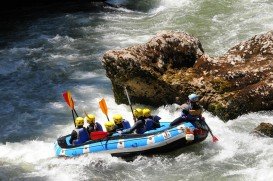
The river in its own unique way is a beautiful scenery with varied wild life and wonderful bird life offering an unforgettable experience. Tana river has grade 3-5 rapids making your whitewater rafting an experience of a life time.
Some have confessed to the adrenaline rush lasting even days after!! Whitewater rafting here is normally done on different degrees of rough waters. The trip would normally take between four and five hours depending on the water levels.
The rafting distance ranges between 8-16 km / 4-9 mi, offering both adrenaline thrills and scenic bird viewing. Best attire to wear is what you wouldn’t mind getting wet. For the people who get sunburned easily, it is advisable to wear long sleeved shirts. Make sure your shoes are tightly fit, otherwise you will leave them in the river!!!
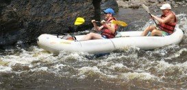
Berthoud Pass is located between Idaho Springs and Winter Park and is one of the closest areas in Denver for whitewater rafting. It belongs to Boulder County and is just an hour away.
Findhorn river will give you a perfect combination of extreme white water rafting, as it is one of the most famous destinations, due to its massive drop gradient of 152 m/500 ft.
L'Argentière-la-Bessée is a commune of the Hautes-Alpes department in the Alps in southeastern France. The village has an old silver mine (which is where the name of L'Argentière derived from), which is now opened to tourists. The town lies on the River Durance, ideal for rafting and other water sports.
Rising from the Eastern Cape and running along the Kwazulu-Natal's western border, the Drakensberg mountain range is the highest in South Africa standing at 3482 m/11424 ft in height. The mountains are capped by a layer of basalt of 1400 m/4593 ft thick and offers amazing flora and fauna.
Wenatchee is the largest city of Chelan County, located in North Central Washington and lies on the west side of the Columbia River. The city is also known as the Apple Capital of the world, due to the valley's many apple cultivations.
The Green Kalahari is located in the Northern Cape, bordering Namibia and Botswana. It is characterized by red dunes, mountain desert and grasslands. Green Kalahari boasts best of both worlds, unspoilt semi-desert with green vineyards at the fertile valley of Orange River and its shimmering waters, which thunder into a deep granite to form the mighty Augrabies Falls.
Sagana is a small town, situated in an edge of a small plain at the southern foot of Mt. Kenya, in Central Province, Kenya and located almost at 62 mi/100 km from Nairobi City.
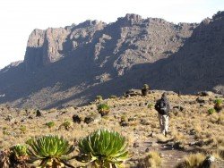
Located almost at 150 km/93 mi from Nairobi City, Mt. Kenya is located just on the south of equator and offers three climbing routes, namely Naro-Moru, Sirimon and Chogoria.
Karen is a suburb of Nairobi City center. It is located in the south west and approximately at 22 km/14 mi from the city center, also known for its European population. The neighborhood was named after the famous Danish author Karen Blixen, who wrote the colonial memoir Out of Africa.
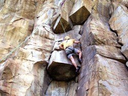
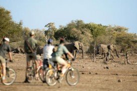
Hell's Gate is located in the South of Lake Naivasha and at about 90 km/55 mi in the northwest of Nairobi City. It covers an area of 68 km²/26.25 mi² and is at 1900 m/6233 ft above sea level. Some of the highlights are the Fischer's tower, Central tower and Hell's Gate gorge. Although there is a wide variety of wildlife, it is famous for a variety of bird species including vultures, verreaux's eagles, swifts and augur buzzards.
Located almost at 150 km/93 mi from Nairobi City, Mt. Kenya is located just south of the equator, offering three climbing routes, namely Naro-Moru, Sirimon and Chogoria. Mt. Kenya has magnificent cliffs and glaciers that protect the highest peaks. Highest peaks here are Batian at 5199 m/17057 ft, Nelion at 5188 m/17021 ft and Point Lenana at 4985 m/16355 ft.
Mt. Longonot is located in the South East of Lake Naivasha and at about 90 km/60 mi from Nairobi City. It stands at 2886 m/9468 ft with dormant volcanoes dominating the landscape. Mt. Longonot is lined with spectacular fissures and lava canyons. It is a strato-volcano with fairly steep slopes covered with volcanic ash.
Hell's Gate is located in the South of Lake Naivasha and at about 90 km/55 mi in the northwest of Nairobi City. It covers an area of 68 km²/26.25 mi² and at 1900 m/6233 ft above sea level. Some of the highlights are the Fischer's tower, Central tower and Hell's Gate gorge. Although there is a wide variety of wildlife, the spot is famous for its variety of bird species including vultures, verreaux's eagles, swifts and augur buzzards.
Located almost at 150 km / 93 mi from Nairobi City, Mt. Kenya is located just south of the equator and has 3 climbing routes, namely Naro-Moru, Sirimon and Chogoria. Mt. Kenya has magnificent cliffs and glaciers that protect the highest peaks. Highest peaks here are Batian at 5199 m / 17057 ft, Nelion at 5188 m / 17021 ft and Point Lenana at 4985 m / 16355 ft.