![Lake Baikal, Siberia](https://www.xtremespots.com/wp-content/uploads/2013/11/Lake-Baikal-Extreme-Hiker-273x148.jpg)
Lake Baikal, Siberia
Lake Baikal is a rift lake, situated in the south of the region of Siberia, between the Republic of Buryatiya to the southeast and the Irkutsk Oblast to the northwest.
Home > MOUNTAIN SPORTS > Extreme Hiking / Hiking > Squaw Valley Ski Resort, Tahoe City
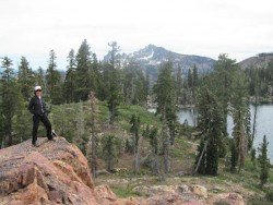
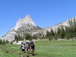
In 2012 it joined forces with Alpine Meadows, offering access to 6000 ac/24.28 km², 43 lifts and over 270 trails. Squaw Valley is the perfect place for hiking. You can choose from a variety of trails. Ride the Aerial Tram to High Camp. Climb to the weathered abutments at the top of Squaw Peak and make a visit to the historic Watson Monument at the Emigrant Park.
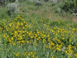
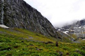
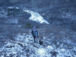
Another option is to meander through the beautiful meadows, feel the intoxicating smell of the wildflowers and enjoy the panoramic vistas of breathtaking landscapes of Squaw’s upper mountain. Trails are easy to moderate and moderate to difficult.
Easy to moderate trails are free guided hikes about 1.5 mi/2.4 km long, High Camp Loop about 1 mi/1.6 km long, High Camp to the top of the Gold Coast Chairlift about 1 mile long and High Camp to the top of the Newport Chairlift about 1.5 mi/2.4 km long and 460 ft/140.2 m elevation gain.
Moderate to difficult trails are High Camp to the top of the Emigrant Chairlift about 1.5 mi/2.4 km long and 500 ft/152.4 m elevation gain, High Camp to the top of the Squaw Peak about 2.2 mi/3.5 km long and 600 ft/182.8 m elevation gain, High Camp to Shirley Lake & down Shirley Canyon about 4 mi/6.4 km long and Thunder Mountain Trail about 4.5 mi/7.2 km long.
Lake Baikal is a rift lake, situated in the south of the region of Siberia, between the Republic of Buryatiya to the southeast and the Irkutsk Oblast to the northwest.
"Jackson, Mississippi: City with Soul" is the current motto for the notorious capital of the U.S. state of Mississippi, which sits atop the Jackson Volcano. Located at the southern border of the Mississippi Delta, Jackson is the capital as well as the largest city in the Mississippi state. The total area of 277 km²/106.95 mi² was inhabited by the Choctaw Nation for thousands of years before European encounter.
Mount Shasta is located in northern California, east of Interstate 5 along SR89, between Mount Shasta city and McCloud city, California, USA.
Wenatchee is the largest city of Chelan County, located in North Central Washington and lies on the west side of the Columbia River. The city is also known as the Apple Capital of the world, due to the valley's apple cultivations.
Mauna Loa is one of the five active volcanoes in the island of Hawaii, the largest one on earth in volume and in kilometers covered. Its peak stands at 13679 ft/4169 m above the sea level.
Badger Pass Ski Area is a small ski area which is located in Yosemite National Park, near Mariposa, California, USA.
Bear Valley is a ski area located near Angels Camp, on highway 4, between Lake Tahoe and Yosemite, approximately 3 hours southeast of Sacramento, California, USA.
Yosemite National Park is located near Mariposa, California, USA.
Bear Valley is a ski area located near Angels Camp, on highway 4, between Lake Tahoe and Yosemite, approximately 3 hrs southeast of Sacramento, California, USA.
Bear Valley is a ski area located near Angels Camp, on highway 4, between Lake Tahoe and Yosemite, approximately 3 hours southeast of Sacramento, California, USA.
Sonora Pass is located near Pinecrest, Tuolumne County, California, USA. It is off of Highway about 60 mi/96.5 km east of Sonora.
Mammoth Lakes is located near Mammoth Mountain, in California’s eastern Sierra about 100 mi/161 km south of Nevada State Line, 9 mi/14.5 km northwest of Mount Morrison, at an elevation of 7880 ft/2402 m, Mono County, California, USA.