
Leadville Trail 100, Leadville
Nested high in the heart of the Rocky Mountains of Colorado and surrounded by amazing glacier lakes and alpine forests, a historic mountain town called Leadville awaits for the nature enthusiasts for a pure adventure.
Home > MOUNTAIN SPORTS > Mountain Biking > Ebbetts Pass, Angels Camp
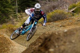
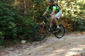
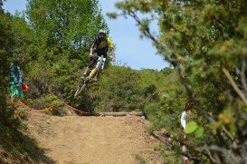
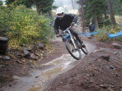
Near Bear Valley lies Ebbetts Pass, which is perfect for mountain biking. Generally in Alpine and Calaveras counties you can find great places for mountain biking. The higher you get, the steeper and wilder the routes become.
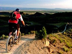
A popular mountain biking route is Arnold Rim Trail, a 10.5 mi/16.9 km trail, which starts at White Pines Lake, west to Sheep Ranch Road, near Avery.
It makes a great ride for bikers and follows San Antonio Creek, crossing from the north side to the south, about 2.5 mi/4 km south of White Pines Lake. Another one is Union Reservoir Loop, a 7 mi/11.3 km loop trail and gravel road. It is a rolling terrain with several hundred feet elevation changes. Bear Valley to Lake Alpine via the Emigrant Trail is another one.
It is a 3.4 mi/5.5 km, one way trail that runs from Bear Valley to Lake Alpine. Cape Horn to Lake Alpine is another trail, which is a 2 mi/3.2 km, single track, starting from the Cape Horn turnout, on Highway 4, down to Lake Alpine. Its rates are close to Black Diamond.
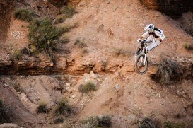
One last trail is Grover Hot Springs to Hawkins Peak, an extreme 7 mi/11.3 km, one way trail from the state park to the summit of 10000 ft/3048 m. The beginning of the trail is at 5800 ft/1768 m. This ride will challenge even the most experienced and best fitted riders.
Nested high in the heart of the Rocky Mountains of Colorado and surrounded by amazing glacier lakes and alpine forests, a historic mountain town called Leadville awaits for the nature enthusiasts for a pure adventure.
Christchurch is situated in Canterbury region of the South Island and is the second largest city of New Zealand. It represents the getaway to Antarctica, while lying next to Pegasus Bay and the Pacific Ocean.
For passionates with mountain bike, the Dolomites mountain group is the top destination. Trentino, in the west side of the Italian Dolomites, is one of the hottest points of the international bike scene.
Houghton is in Michigan’s Upper Peninsula and the largest city of Copper County. It is also in the list of the “100 Best Small Towns in America”. Houghton is surrounded on the east by Portage Township and Pilgrim, on the south by Hurontown and Isle Royale Location and on the west by Dakota Heights. The area is ideal for varied winter as well as summer sports, such as ice hockey, snowmobiling, hiking, sea kayaking, sailing, mountain biking etc.
Emporia is a city in and the county seat of Lyon County, located at 58 mi/93 km in the south west of Topeka City and 88 mi/141 km in the northeast of Wichita, Kansas, USA.
Lecht 2090 Resort is located within the eastern Cairngorms mountain range.
Sonora Pass is located near Pinecrest, Tuolumne County, California, USA. It is off of Highway about 60 mi/96.5 km east of Sonora.
Sugar Bowl ski resort is a ski area in northern Placer County, near Norden, along Donner Pass of Sierra Nevada, at about 46 mi/74 km from Reno on Interstate 80, California, USA. The resort was opened on the 15th of December, 1939.
Bear Valley is a ski area located near Angels Camp, on highway 4, between Lake Tahoe and Yosemite, approximately 3 hours southeast of Sacramento, California, USA.
Sonora Pass is located near Pinecrest, Tuolumne County, California, USA. It is off of Highway about 60 mi/96.5 km east of Sonora.
Mount Shasta is located in northern California, east of Interstate 5 along SR89, between Mount Shasta city and McCloud city, California, USA.
Tamarack Lodge Resort is located in Mammoth Lakes, near Mammoth Mountain, in California’s eastern Sierra about 100 mi/161 km south of Nevada State line Mono County, California, USA.
Sonora Pass is located near Pinecrest, Tuolumne County, California, USA. It is off of Highway about 60 mi/96.5 km east of Sonora.
Bear Valley is a ski area located near Angels Camp, on highway 4, between Lake Tahoe and Yosemite, approximately 3 hrs southeast of Sacramento, California, USA.