Tombstones Beach, Hilo
Tombstones beach is located between Paukaa and Wainaku Village Hawaii, at about seven minutes drive from Hilo, which is the most populated city on the island.
Home  > BOARD SPORTS  > Surfing  > Warriewood Beach, Warriewood
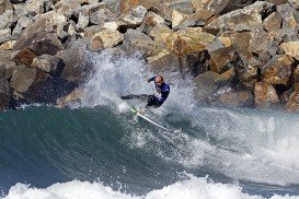
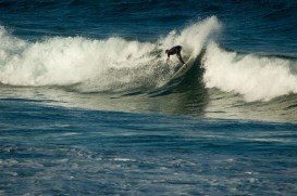
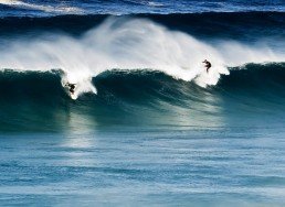
This spot is an exposed point break and has dependable surf at all stages of the tide. Surfers can explore the waves with swell sizes from 3 ft (1 m) to 8 ft (2.5 m). The best tide movement is falling tides. The beach is appropriate for experienced surfers.
Offshore winds blow from the south, southwest and the best swell direction is from the east, southeast. In summer the wind blows offshore at 31%, in autumn the wind blows at 46%, in winter at 39% and in spring at 29%. The average water temperature is about 21ºC/69.8ºF.
Watch out for rocks, rips and pollution. Note: the beach is crowded during weekends.

Tombstones beach is located between Paukaa and Wainaku Village Hawaii, at about seven minutes drive from Hilo, which is the most populated city on the island.
Fistral beach is the main beach for surfing practice in Newquay.
Honokaa town is located in the Hamakua Coast, at 64 km/40 mi in the north of Hilo. The area is a historic district on Big Island, Hawaii because the town's economy was once based on sugar production from the Hamakua Sugar Company, until 1994.
'Chinamans' is a powerful and hollow left hand reef break, located close to Marion Bay at Yorke Peninsula. The spot breaks in shallow water and washes over a rock shelf. This becomes a high quality wave that is suitable only for skilled surfers and caution should be used when surfing here.
Ericeira is a seaside resort and fishing community that belongs to the municipality of Mafra, situated on the western coast of Portugal. The resort is a popular destination to many surfers, since the area hosts more than 40 beaches with excellent surfing conditions.
Kailua Kona is located in the North Kona District, Hawaii. It is a lively seaside town with sunny tropical weather all year long and lies at the bottom of the Hualalai Volcano.
Mona Vale is a suburb in northern Sydney, at about 28 km/17 mi in the north of Sydney's CBD (Central Business District). Mona Vale beach streches at about 1 km/1093.6 yd in between the broad rock platform that divides it from the Basin on the north side and the Warriewood beach, on the south side. This spot provides you with good facilities and a picnic area.
Cronulla is a beach-side suburb in southern Sydney, at about 26 km/16 mi in the south of Sydney's CBD (Central Business District). Cronulla lies on a peninsula, between Botany Bay on the north and Port Hacking on the south. Cronulla is a popular tourist location and attracts many beach enthusiasts.
Bondi beach is the widest and most famous beach in the Sydney region. It is located in the suburb of Bondi, at just 7 km/4 mi from the center of Sydney. This spot is a combination of great surf with good food and idyllic atmosphere.
Clovelly is a beachside suburb of Sydney, at about 8 km/4 mi in the south-east of Sydney's CBD (Central Business District).
Dee Why is a suburb of northern Sydney, at about 18 km/11 mi north-east of Sydney's CBD (Central Business District). Dee Why caters a variety of dining and accommodation options to suit different needs and budgets.
Coogee is a beach-side suburb of Sydney, at about 8 km/4 mi in the south-east of Sydney's CBD (Central Business District).