
Mount Parnitha, Athens
Mount Parnitha is located in the North Athens regional unit and is the highest mountain range of Attica. Much of this densely forested mountain is designated a national park, and is a protected habitat for wild birds.
Home Ā >Ā MOUNTAIN SPORTS Ā >Ā Mountain Biking Ā >Ā El Ejido, Almeria
El Ejido enjoys a Mediterranean climate, with mild winters (12°C/53.60°F) and hot summers (28°C/82.40°F). Rainfall is low with wettest months December and January. Wind strength is about 3-5 Bft with April reaching more than 5 Bft.
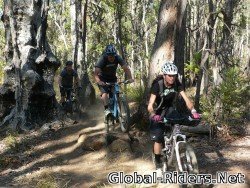
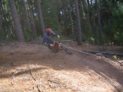
El Ejido is quite known in the area for its routes, either inside the El Ejido, traveling at suburb area biking sideways the road lanes, or the long seaside Ā routes.Ā Many mountain trails for the nearby mountains have starting points at El Ejido.
Famous event is the El Ejido Mountain Bike Marathon Trail whichĀ passes through the Sierra de Gador, at the foot of the Sierra Nevada. It’s an annual eventĀ (counting many marathons so far), with a lot of mountain bike clubs and known bikers.
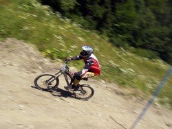
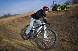
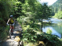
Known routes: Penas Negras to Atajuelos, at pavilion of Ejido,Ā around 25km/15mi with medium to high physical difficulty. Same difficulty level at 30 km/19 mi is the Sierrecilla route. You can also travel between nearby areas like Celin – Antenas – Chanata – Felix – Bernal (quite difficult routes). A nice route is from San Agustin with first stop at Almerimar beach, through Matagorda or Guardias Viejas to Balanegra beach, it’s a nice seaside trip, quite easy, to know El Ejido and its surrounding area.
Don’t miss the natural park of Punta Entinas – Sabinar trail. Organize your trip at the annual mountain bike marathon, visit area clubs and plan mountain bike trips at the area of El Ejido.
Mount Parnitha is located in the North Athens regional unit and is the highest mountain range of Attica. Much of this densely forested mountain is designated a national park, and is a protected habitat for wild birds.
Pasir Ris in Malay means "beach bolt-rope", simply implying a narrow beach. It is geographically divided into three regions, namely Loyang (East) Central and Elias (West). Due to its proximity to the sea, it has several recreation facilities and has a keenly preserved mangrove forest with boardwalks to allow visitors get closer to the inhabitants. The full length of the park is around 6.6 km/4.1 mi long.
Cincinnati is situated in Hamilton County, Ohio, USA. The city is nestled on the north bank of the Ohio river right at the border of Ohio-Kentucky, near Indiana.
Volcano National park is located at 30 mi/48 km in the southwest of Hilo Town in Hawaii. The park was established in 1916 and is a combination of unique ecosystems and diverse environments that range from the sea, to the summit of the world's biggest volcano, Mauna Loa, as well as Kilauea witch is the world's most active volcano.
Wanaka is a small town in Central Otago in the South Island of New Zealand, situated on the south side of Lake Wanaka.
Te Anau is a small town, situated in Fiordland region, in the South Island of New Zealand.
Mojacar is a municipality of Almeria province located in the southwest. This typical Mediterranean sunny village lies between Carboneras and Garrucha, bordering the Sierra Cabrena mountains and the Mediterranean sea. Mojacar is a typical Mediterranean sunny village with more than 3000 hours of sun per year.
Roquetas de Mar is a municipality, located in the west of Almeria province. It is the most popular town of Almeria, with direct coastal access to the Mediterranean Sea.
Mojacar is a municipality, located at 90km/56 miles away from the center, in the southwest of Almeria province. This village lies between Carboneras and Garrucha, bordering the Sierra Cabrena mountains with the Mediterranean sea. The village has been inhabited by Phoenicians, Greeks and Romans throughout the ancient times, leaving as a legacy behind their architecture style. The whole village is build on the top of the hill with white traditional buildings surrounded by a big labyrinth of small narrow streets.
Sierra Nevada's ski resort lies on the Veleta peak, in the Granada part of the mountain. Your starting point is Pradollano. From there, the first lifts take you to the main hub, Borreguiles, at about 457 m / 1500 ft above the main village. Up the hill starts the Loma de Dilar track, which will take you to your destination.
El Ejido is a municipality of Almeria province, in the autonomous community of west Andalusia. It lies between the mountain range of Sierra de Gador and the Mediterranean Sea. Neighboring municipalities are Dalias and Vicar, Berja and Roquetas de Mar.
Roquetas de Mar is a municipality, located in the west of Almeria province. It is the most popular town of Almeria, with direct coastal access to the Mediterranean Sea. It was once a traditional fishing town, but now is a low key tourist resort town, designated as a National Tourist Amenity since 1967.
Almeria is a province of the Autonomous Community of Andalusia, between Enix, Pechina and Nijar. With mountain sierras and 40 km / 25 mi of seacoast terrain, Almeria is a great destination for extreme sport enthusiasts.
Almeria is a province of the Autonomous Community of Andalusia, between Enix, Pechina and Nijar. With mountain sierras and a 40 km/25 mi of seacoast terrain, Almeria is a great destination for extreme sport enthusiasts.