
Alum Creek State Park Phase 1, Lewis Center
Lewis Center is situated in northwestern Orange Township, Delaware County, Ohio, USA. It is an unincorporated community standing between Columbus and Delaware.
Home > MOUNTAIN SPORTS > Mountain Biking > Harpers Loop, North Little Rock
Harper’s Loop offers a smooth flat scenic ride into the classic Arkansas Delta area and past some picturesque scenery such as pecan groves and cotton fields. The long version is a 37 mi / 59.5 km signed cycling route, starting from the Arkansas River Trail in North Little Rock to end up in Hwy 165. The shorter route starts at the Plantation Agricultural Museum State Park, continues to England and by making it right onto Hwy 161, it ends up back to Scott.
Since it’s a flat ride –the entire 37 mi / 59.5 km area hosts only 116 ft / 35.36 m of climbing- we suggest that you take the long version. Elevation starts at 226 ft / 69 m and reaches a maximum of 272 ft / 83 m, making it a well suited ride for any rider. Nonetheless don’t you ever think that because of its flatness, that the ride doesn’t present a challenge.
Some of the trail is on frequently traveled roads and the area is in the center of some strange meteorological phenomena that can be tricky. Due to the “setbacks” mentioned before, but also the length of the route, we suggest that you ride this one in a group. After all, you might want to have an extra challenge, like a race or somebody to take some shots of you riding past the beautiful scenery.


Lewis Center is situated in northwestern Orange Township, Delaware County, Ohio, USA. It is an unincorporated community standing between Columbus and Delaware.
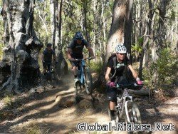
The Dell in Kalamunda is Perth’s number one mountain bike location, at 40 km/24 mi in the east of Perth. The location offers numerous trails, centered primarily around Mount Gunjin. There are plenty of tracks on the spot, the more you ride, the more you find.

Hamburg (Free and Hanseatic City of Hamburg) is the second largest city in Germany, the thirteenth largest German state and the sixth largest city in the European Union. It is situated on the river Elbe while its port is the second largest port in Europe and tenth worldwide. Hamburg is known for its big sporting activity among others.

Since the early 1990s, Thredbo, located at 500 km/310 mi in the south of Sydney, has been a popular destination in summer for recreational and competitive mountain biking, attracting prominent racers from all over Australia and overseas.

Methven is a small town in Canterbury region of the South Island. It is only 1.5 h drive at the west of Christchurch, the second largest city of New Zealand and is situated close to Mount Hutt, in the heart of Southern Alps.

Topeka is located along the Kansas River in the central part of Shawnee County, situated in northeast Kansas, in the central United States. It is the capital city of the state of Kansas and the county seat of Shawnee County.
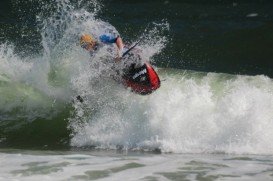
Outer Banks, also known as OBX, is a 200 mi/322 km long string of narrow barrier islands of the coast of North Carolina. A small portion of it extends further in Virginia, at the beginning of the southern corner of Virginia Beach, on the east coast of the United States. It is a major tourist destination and known for its temperate climate.

In order to enjoy themselves, many people viist Atlantic Beach every year. It is a town in Carteret Country, North Carolina, United States. Atlantic Beach is one of the five communities, located on Bogue Banks.
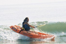
Outer Banks, also known as OBX, is a 200 mi/322 km long string of narrow barrier islands of the coast of North Carolina. A small portion of it extends further in Virginia, at the beginning of the southern corner of Virginia Beach, on the east coast of the United States. It is a major tourist destination and known for its temperate climate.

North Little Rock, located across the picturesque Arkansas River in Pulaski County, Arkansas includes among others beautiful lakes, magnificent parks, walking and bicycling trails, recreational and entertainment facilities, bars and restaurants, which bloom throughout the city.

Little Rock is the capital of Arkansas and it is situated on the south bank of the Arkansas River. It has its name taken from the French explorer Benard de LaHarpe in 1721. It is a historic city with many museums, such as the Central High Museum, Children’s Museum and Discovery Museum. It also features awesome restaurants and exciting nightlife and offers many recreational activities to visitors.
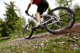
Daytona Beach is located in Volusia County and is famous world wide among the race fans for the Daytona International Speedway. Bordered by the Atlantic Ocean, the city hosts an amazing coastline and beautiful sandy beaches, attracting visitors from all over the states. It is also known for the hard packed sand on which you can drive your vehicle and visit restricted areas.

The well-known City Mountainbike, a UCI XCE mountain biking competition that was originaly based in Belgium and then in the Netherlands, is currently heading to USA! You can now race your mountain bike in a brand new destination, Columbus, Georgia!

Hazlehurst is situated in the southeast Georgia, USA. It lies between the borders of Jeff Davis, Bacon and Appling counties but its main part belongs to Jeff Davis County. Hazlehurst is the county seat of Jeff Davis County with a population that continuously rises up. The city and its surroundings is perfect for off-road sports, extremely popular among quad biking riders in the area.

