
Bamburi Beach, Mombasa
Bamburi Beach is a 20 minutes drive from Mombasa town and 45 minutes from Mombasa International airport. It overlooks the calm waters of the Indian Ocean and within the Mombasa Marine Park.
Home > WATER SPORTS > Kayaking > Carmel River State Beach, Monterey
It is a 1 mi/1.6 km long, breathtaking, public beach with a beautiful lagoon formed by the Carmel River. Carmel River State Beach merges with San Jose Creek State Beach (Monastery Beach). The park was established in 1953. In the lagoon immigrate a large number of migratory birds.
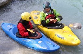
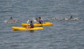
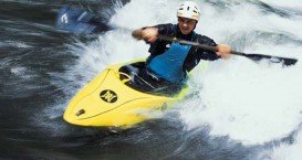
Winter and fall are the best seasons for bird watching. Carmel River State Beach at the section of Central Coast Birding Trail is believed to be one of the most dangerous places for swimming, because of the steep drop – off from shore creating turbulent waves that are incorrectly shown as calm sea and the strong currents. Carmel River State Beach is a hot spot for kayaking.
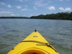
There is a lot of marshy water to paddle through, big variety of birds to watch and when kayakers join the mouth to the river, it seems endless. Kayakers should be careful, because the unusual drop – off near the shore can make the sea look deceptively calm.
Bamburi Beach is a 20 minutes drive from Mombasa town and 45 minutes from Mombasa International airport. It overlooks the calm waters of the Indian Ocean and within the Mombasa Marine Park.
At the mouth of Bensafrim River and along the Atlantic ocean, you can find Lagos. It's a municipality in the Barlavento region of the Algarve, in Portugal. It's a place with historical meaning.
Kodiak Island is the second largest island in the United States and the largest in the Kodiak Archipelago. The island is situated on the south coast of Alaska and it is separated from the mainland by the Shelikof Strait.
Spring Lake is a borough in Monmouth County, New Jersey, United States. The spot is commonly known as the "Jewel of Jersey Shore". New Jersey Monthly magazine ranked Spring Lake as the 240th best place to live in New Jersey. So, grab the opportunity and visit this well-known place.
The Virgin Islands of the United States, or the U.S. Virgin Islands lie in the Caribbean Sea, east of Puerto Rico. This group of islands consist of the main islands of Saint Thomas, which is home to the capital city of the U.S. Virgin Islands, Saint John, Saint Croix, Water Island and other surrounding minor islands.The climate here is classified as tropical savanna climate, mostly affected by moderate trade winds.
Germasogia is a village in Limassol district area, on the South coast of Cyprus. It was built, in ancient times, between two mountains so that it'd be hidden from enemies during the times when the island was in wars. Now, it is privileged to be surrounded by the same, yet evolved, beautiful scenery.
Soda Springs ski resort is located near Soda Springs, Nevada County, California, USA. Soda Springs ski resort is just off of Highway 80, near the Donner Summit.
Yosemite National Park is located near Mariposa, California, USA.
La Ventana is located on the south-eastern side of Baja California Sur, Mexican state. Baja California Sur is the second smallest Mexican state by population and is situated in northwestern Mexico. It is bordered to the west by the Pacific Ocean and to the east by the Gulf of California.
Soda Springs ski resort is located near Soda Springs, Nevada County, California, USA. Soda Springs ski resort is just off of Highway 80, near the Donner Summit.
Mammoth Lakes is located near Mammoth Mountain, in California’s eastern Sierra about 100 mi/161 km south of Nevada State Line, 9 mi/14.5 km northwest of Mount Morrison, at an elevation of 7880 ft/2402 m, Mono County, California, USA.
Peniche is a municipality and a seaside city, situated in formerly Estremadura Province, in Oeste Subregion. The municipality consists of 6 parishes and it is a popular surfing destination.
Badger Pass Ski Area is a small ski area which is located in Yosemite National Park, near Mariposa, California, USA.
Mammoth Lakes is located near Mammoth Mountain, in California’s eastern Sierra about 100 mi/161 km south of Nevada State Line, 9 mi/14.5 km northwest of Mount Morrison, at an elevation of 7880 ft/2402 m, Mono County, California, USA.