

ADD COMMENT
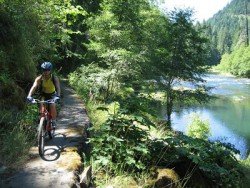
North Umpqua River, Roseburg
/
Oregon USA
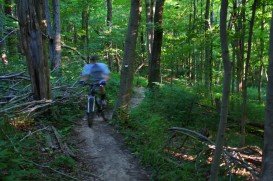
This is a trail extended parallel to North Umpqua River, covering more or less 60 mi/96.56 km in the area.
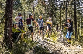
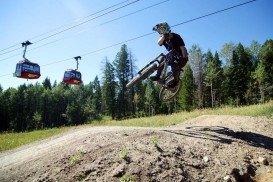
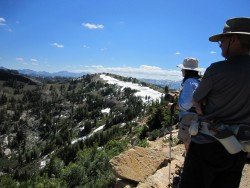
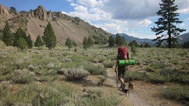
A popular sport at Sonora Pass is mountain biking. There are mountain biking trails along the Sonora Pass highway. You will find everything you need from gentle, railroad grades to steep, single tracks. There are great logging roads, perfect to explore.
Purchase a map of Stanislaus National Forest at the ranger station in MiWuk or Pinecrest and also a map of Toiyabe National Forest at the Bridgeport ranger station. A popular trail is Hull Creek to Clavey River. It is a 9 mi/14.5 km route on the old West Side Lumber Company’s railroad line.
The easy grade is guaranteed on old railroad routes. This trail, however, is kind of tricky to reach and difficult to follow. It is perfect, if you are an adventurous type and carry a map and compass or GPS. When leaving Long Barn take the North Fork Road or the Merrill Springs Road.
Afterwards follow the Merrill Spring Road to Hull Creek and Clavey River. Then cross the North Fork of the Tuolumne River and after 6 mi/9.6 km meet Forest Road 3N07. Pay attention for a sign, marking the West Side Rail Tour.
This is a trail extended parallel to North Umpqua River, covering more or less 60 mi/96.56 km in the area.
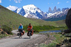
Torres del Paine is located in Southern Patagonia and is one of the numerous and spectacular national parks in Chile. It was created in 1959 and UNESCO has listed the location as a Biosphere Reserve since 1978. This place is a wonderland for nature enthusiasts from all over the world.
Thessaloniki is located in northern Greece. It is the second largest city and a major economic, industrial, political and commercial center. The city is well known for its endless entertainment including abundant cultural festivals. Thessaloniki has been ranked as one of the best tourist destinations worldwide.
Kulani is a mountain located South of Hilo district, Hawaii. The nearest places to Kulani forest are Na Lua Mahoe, Pu'ulala'au natural area reserve and Upper Ola'a Forest reserve.
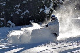
If you feel that it is time for action, get a move on and visit Kicking Horse Mountain Resort as soon as possible. It is situated 14 km/8 mi outside of Golden, British Columbia, Canada. The fact that this place has the fourth highest vertical drop in North America attracts many people from all over the world.
Longmont is located northeast of the county seat of Boulder, about 31 mi/49.9 km north-northwest of the Colorado state capitol in Denver. It is a home rule municipality in Boulder, Weld Counties in the U.S. state of Colorado.
Dodge Ridge ski resort is located near Pinecrest, Tuolumne County, California, USA. It is off of Highway about 50 mi/80.5 km east of Sonora.
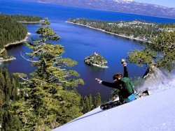
Squaw Valley Ski Resort is located in Olympic Valley, California, USA. It is one of the largest ski areas in the US after Heavenly and was the site of the 1960 Winter Olympics.
Bear Valley is a ski area located near Angels Camp, on highway 4, between Lake Tahoe and Yosemite, approximately 3 hours southeast of Sacramento, California, USA.
Mammoth Lakes is located near Mammoth Mountain, in California’s eastern Sierra about 100 mi/161 km south of Nevada State Line, 9 mi/14.5 km northwest of Mount Morrison, at an elevation of 7880 ft/2402 m, Mono County, California, USA.
Kirkwood Mountain Resort is a year round resort in Kirkwood, south of Lake Tahoe, in El Dorado County, California, USA. Kirkwood is at 33 mi/53 km south of South Lake Tahoe, on State Route 88 and it is surrounded by El Dorado National Forest.
Mammoth Lakes is located near Mammoth Mountain, in California’s eastern Sierra about 100 mi/161 km south of Nevada State Line, 9 mi/14.5 km northwest of Mount Morrison, at an elevation of 7880 ft/2402 m, Mono County, California, USA.
Sonora Pass is located near Pinecrest, Tuolumne County, California, USA. It is off of Highway about 60 mi/96.5 km east of Sonora.
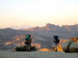
Sonora Pass is located near Pinecrest, Tuolumne County, California, USA. It is off of Highway about 60 mi/96.5 km east of Sonora.


