Routeburn Track, Glenorchy
Glenorchy is a small settlement, situated in Otago region at South Island in New Zealand. It lies on the northern side of Lake Wakatipu and is surrounded by Richardson and Humboltd Ranges.
Home > MOUNTAIN SPORTS > Backpacking / Trekking > Calaveras Big Trees State Park, Angels Camp
Near Bear Valley lies Ebbetts Pass, which is perfect for backpacking. Day hikes can vary from unstrained, quarter mile walks to full day excursions on strenuous mountain peaks. One of the best route is Calaveras Big Trees State Park. It is a 1.5 mi/2.4 km loop with smooth walking surface.
The north grove is close to the parking and has easy access. Some of the best things to see on that trail are the Empire State Tree, Big Stump, the Father of the Forest and Pioneer Cabin Tree. Empire State Tree has 18 ft/5.4 m diameter near its base. South Grove is a 3.5 mi/5.6 km, loop forest trail.
The elevation changes are 500 ft/152.4 m, gain and loss. Both of the trails begin with a moderate uphill climb. Bradley Grove trail is a 2.5 mi/4 km, loop forest trail. The elevation changes are 200 ft/61 m, gain and loss. The trail contains some huge sequoias and many younger trees that were planted in 1950’s.
Glenorchy is a small settlement, situated in Otago region at South Island in New Zealand. It lies on the northern side of Lake Wakatipu and is surrounded by Richardson and Humboltd Ranges.
Bali is a province in Indonesia with a few neighboring islands including the Isle of Bali. The island of Bali lies at about 8 degrees/ 0.13 radians on the south of equator and at 3.2 km/1.9 mi from Java. It is surrounded by coral reefs with white sand beaches on the south and black sand beaches on the north and the west of the island.
Te Anau is a small town, situated in Fiordland region, in the South Island of New Zealand.
Methven is a small town in Canterbury region of the South Island. It is only 1.5 h drive at the west of Christchurch, the second largest city of New Zealand and is situated close to Mount Hutt, in the heart of Southern Alps.
Yosemite National Park is located near Mariposa, California, USA.
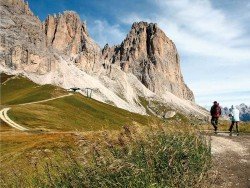
Bear Valley is a ski area located near Angels Camp, on highway 4, between Lake Tahoe and Yosemite, approximately 3 hours southeast of Sacramento, California, USA.
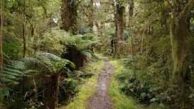
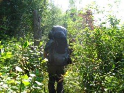
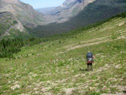
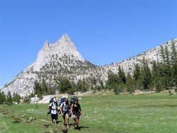
Tamarack Lodge Resort is located in Mammoth Lakes, near Mammoth Mountain, in California’s eastern Sierra about 100 mi/161 km south of Nevada State line Mono County, California, USA.
Mount Shasta is located in northern California, east of Interstate 5 along SR89, between Mount Shasta city and McCloud city, California, USA.
Mammoth Lakes is located near Mammoth Mountain, in California’s eastern Sierra about 100 mi/161 km south of Nevada State Line, 9 mi/14.5 km northwest of Mount Morrison, at an elevation of 7880 ft/2402 m, Mono County, California, USA.
Mammoth Mountain is located in California’s eastern Sierra, at 100 mi/161 km south of Nevada State line and 50 minutes from the Eastern Gate of Yosemite National Park.
Sonora Pass is located near Pinecrest, Tuolumne County, California, USA. It is off of Highway about 60 mi/96.5 km east of Sonora.
Dodge Ridge ski resort is located near Pinecrest, Tuolumne County, California, USA. It is off of Highway about 50 mi/80.5 km east of Sonora.
South Lake Tahoe is located on the California–Nevada border, El Dorado County, California, USA.
