
Chapin Memorial Beach, Cape Cod
Chapin Memorial Beach is an impressive, white sand beach at the North West of Dennis, Cape Cod.
Home > BOARD SPORTS > Surfing > Point St. George, Crescent City
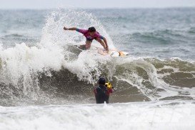
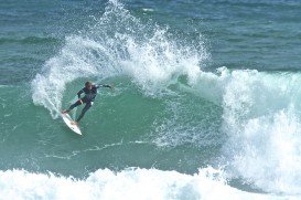
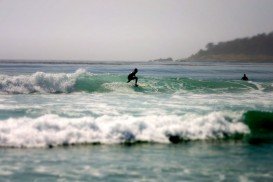
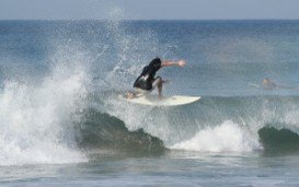
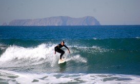
Point St. George is to the north and the beach is near the end of Pebble Beach Drive (Radio Drive). It is one of the best breaks in the area. It is an exposed rocky shelf, point break and reef. Beach access is not easy, so it is not a popular place for swimming, but it is a popular place for surfers.
Next to the beach, there is a long trail and rocky shoreline from the bluffs. Visitors find razor, beds of little-neck and Washington clams. They also find smelt netting and rock fishing. The beach is in walking distance from Crescent City (about 5 minutes). It is easy to find and accessible.
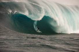
Wave quality is regional classic and it requires experienced surfers. Frequency of the wave is regular. Type of the wave is reef – rocky and direction is left. Bottom of the sea is reef (sharp rocks, coral etc.). Power of the wave is fast, powerful and fun.
Its regular length is normally 164 to 492 ft/50 to 150 m and on good days it is long, up to 492 to 800 ft/150 to 300 m. Good swell direction is North, Northwest, West, Southwest and good wind direction is Southeast, East. Swell size starts at 1 m – 1.5 m / 3 ft – 5 ft and holds up to 2.5 m+ / 8 ft+.
Best tide position is mid tide and best tide movement is rising and falling tides. Surfers should be alerted for urchins, rips/underflow, rocks and sharks.
Chapin Memorial Beach is an impressive, white sand beach at the North West of Dennis, Cape Cod.
Puerto Rico is situated in the northeastern Caribbean and consists of an archipelago that includes the main island of Puerto Rico and a number of smaller islands. The climate here is classified as tropical marine climate, with an average temperature of 82.4°F/ 28°C, throughout the year. Although it is a small island, the smallest island of the Greater Antilles, Puerto Rico provides superb natural surroundings, countless adventure experiences and many places of historical interest.
Daily Heads is another great surfing spot in Yorke Peninsula, close to Innes National Park and the Marion Bay. Marion Bay is the doorstep to some of the best beaches in Australia that host a rich maritime history.
Cisco beach is situated in the south-west of Nantucket island, which is at around 30 mi / 48 km in the south of Cape Cod.
Wilderness is a resort, lying between the Outeniqua mountains and beautiful warm waters of the Indian Ocean in Western Cape, South Africa. A rich natural landscape with beautiful beaches and a number of rivers and lakes, Wilderness offers considerable amount of tranquility making it a perfect beach holiday spot. Climate is warm all year round with winters offering sunny and warm days.
Tasmania is Australian island state, located at 240 km/150 mi in southeast of Australia's mainland. The island of Tasmania is an ideal destination, as it offers a diverse vegetation with many unique flora and fauna species, dense forests, pristine beaches and ideal weather conditions to perform your favorite extreme activity.
Big Lagoon is located at 7 mi/11.3 km north of Trinidad, Humboldt County, California, USA.
Mount Shasta is located in northern California, east of Interstate 5 along SR89, between Mount Shasta city and McCloud city, California, USA.
Enderts beach is located 3 mi/4.8 km south of Crescent City off Highway 101 Paved beach. Crescent city is in Del Norte County, California, USA.
Big Lagoon is located at 7 mi/11.3 km north of Trinidad, Humboldt County, California, USA.
Lake Talawa is located in Talawa Dunes State Park, north of Crescent City, Del Norte County, California, USA.
Lake Earl is located in Talawa Dunes State Park, north of Crescent City, Del Norte County, California, USA.
Mount Shasta is located in northern California, east of Interstate 5 along SR89, between Mount Shasta city and McCloud city, California, USA.
Rogue River is situated in southwestern Oregon, near the city of Grants Pass.