Kennedy Meadows, Sonora
Sonora Pass is located near Pinecrest, Tuolumne County, California, USA. It is off of Highway about 60 mi/96.5 km east of Sonora.
Home > MOUNTAIN SPORTS > Backpacking / Trekking > Mount Shasta, Redding
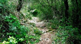
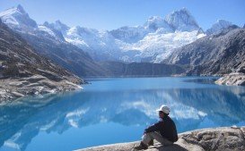
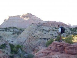
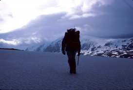
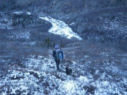
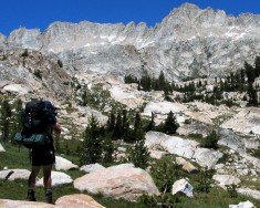
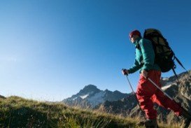
Mount Shasta is inside Shasta – Trinity National Forest and the second highest volcano in the Cascade Range. It is the perfect place for Back-country Backpacking. The trails offer spectacular scenery and occasionally a sight of many wild animals such as bears, deer and eagles.
Most trails are round trips, but trails, listed as strenuous are better to be hiked, only if you are in a very good physical condition. When you pick a camping point, make sure that it has adequate water runoff and use plastic under your tent to stay dry.
If you go backpacking in early spring, prefer to camp on snow than on fragile damp areas of earth. Try to use an already used camping spot, so you won’t expand camping area. Watch out for bears, they are present in the wilderness, so hang your food away from the camp.
If you want to burn a campfire, do it only in established fire pits. Best season to go backpacking is from early April until late October, depending on weather conditions and snow.
Sonora Pass is located near Pinecrest, Tuolumne County, California, USA. It is off of Highway about 60 mi/96.5 km east of Sonora.
Mount Shasta is located in northern California, east of Interstate 5 along SR89, between Mount Shasta city and McCloud city, California, USA.
Located almost at 150 km/93 mi from Nairobi City, Mt. Kenya is located just south of the equator, offering three climbing routes, namely Naro-Moru, Sirimon and Chogoria. Mt. Kenya has magnificent cliffs and glaciers that protect the highest peaks. Highest peaks here are Batian at 5199 m/17057 ft, Nelion at 5188 m/17021 ft and Point Lenana at 4985 m/16355 ft.
Sonora Pass is located near Pinecrest, Tuolumne County, California, USA. It is off of Highway about 60 mi/96.5 km east of Sonora.
In the surroundings of Lake Garda, several types of trekking or/and Nordic walking can be practiced easily in a very pleasant and relaxed way.
Mammoth Lakes is located near Mammoth Mountain, in California’s eastern Sierra about 100 mi/161 km south of Nevada State Line, 9 mi/14.5 km northwest of Mount Morrison, at an elevation of 7880 ft/2402 m, Mono County, California, USA.
Sonora Pass is located near Pinecrest, Tuolumne County, California, USA. It is off of Highway about 60 mi/96.5 km east of Sonora.
Pebble beach is an incorporating community in Monterey County, in the Monterey Peninsula, California, USA. Partially Pebble beach belongs to Del Norte Forest Foundation.
Mammoth Lakes is located near Mammoth Mountain, in California’s eastern Sierra about 100 mi/161 km south of Nevada State Line, 9 mi/14.5 km northwest of Mount Morrison, at an elevation of 7880 ft/2402 m, Mono County, California, USA.
Sonora Pass is located near Pinecrest, Tuolumne County, California, USA. It is off of Highway about 60 mi/96.5 km east of Sonora.
Yosemite National Park is located near Mariposa, California, USA.
Bear Valley is a ski area located near Angels Camp, on highway 4, between Lake Tahoe and Yosemite, approximately 3 hours southeast of Sacramento, California, USA.

