Kiteboarding / Kitesurfing in Long Bay, Anguilla,
Anguilla
Maximum wind speed:
25knots
Average temperature:
27.7˚C/81.8˚F
Wind direction:
NE,E
Anguilla is a tropical island in the northern Caribbean Sea. It is situated in the north side of Saint Martin and in the east of Puerto Rico and the Virgin Islands. Anguilla belongs to the Leeward Islands, a group of islands in the West Indies. Leewards Islands are located just on the point where Caribbean Sea meets with the Atlantic Ocean.
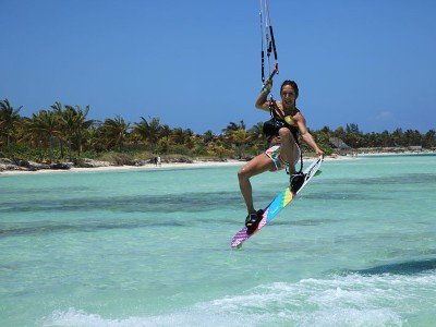
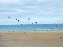
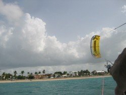
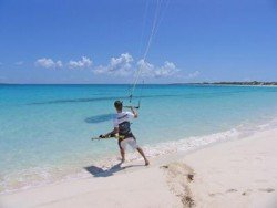
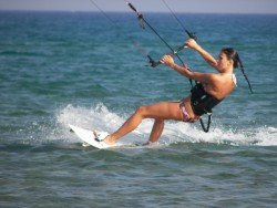
Anguillas’ white sandy beaches and turquoise seas will absolutely take your breath away. Long Bay is located on the eastern side of Meads Bay and on the western side of Crocus Bay. It’s a wonderful place for kitesurfing with a northeast wind in winter or with an east wind in summer. The intensity of the wind is approximately 25 knots in high season. There are two periods when the winds are pretty strong. The first one lasts from December to March and the second period lasts from June to July. The other months, the wind speed falls to 16 knots.
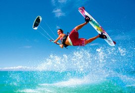
The average temperature is about 27.7˚C/81.8˚F during all year, with a difference of 3 points between the winter and the summer. The temperature of the water is about 1 to 2 points less. The style that kite-surfers may try is mostly free-ride, freestyle and bump and jump. The hurricane period that lasts from August to December affects the weather. The rainy days are about 14 during these months. The weather conditions nevertheless are not so strong in order to prevent kitesurfers from enjoying the sea.
South Padre Island is a resort town in Cameron County, Texas, U.S. If you want to enjoy your holidays and escape from the anxious routine, visit this amazing island, which is known for its white, sunny beaches. Discover this sea paradise and forget all your worries.
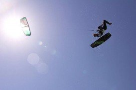
Some of you have drunk a "'long island'" cocktail, a strong combination of five potations. It makes you feel free, a little dizzy, powerful, excited, ready for mystery games. For those who want something more, then kite-surf is a good choice. It represents the "long island'" cocktail of extreme sports. It combines aspects of windsurf, gymnastics, wake-board, surf and para-glide.
Fuerteventura, loosely translated as "Strong Winds" or a corruption of French Forte Aventure (Great Adventure), is one of the Canary Islands, situated in the Atlantic Ocean off the coast of Africa and administered by Spain. Costa Calma is a beach holiday resort town in Fuerteventura, located in the southern part of the island.
Puerto Rico is situated in the northeastern Caribbean and consists of an archipelago that includes the main island of Puerto Rico and a number of smaller islands. The climate here is classified as tropical marine climate, with an average temperature of 82.4°F/ 28°C, throughout the year. Although it is a small island, the smallest island of the Greater Antilles, Puerto Rico provides superb natural surroundings, countless adventure experiences and many places of historical interest.
Düsseldorf is the center of the Rhine – Ruhr metropolitan region and the capital city of the German state of North Rhine – Westphalia. It is known for its fine arts, its relatively large Japanese community and its pioneering influence on experimental – electronic music. Nonetheless, Düsseldorf is also famous for its extreme sports activities, being performed in the wider area.
Prickly Pear Cays are a pair of uninhabited islands, the Prickly Pear East and the Prickly Pear West. They are about at 9.6 km/6 mi in the north-western of Anguilla. Anguiila belongs to the Leeward Islands in Caribbean Sea. It is located on the north of Saint Martin and on the west of Puerto Rico and the Virgin Islands.
Cove Bay is situated on the southern side of Anguilla. Anguilla belongs to Leeward Islands in the West Indies and lying on the west of Puerto Rico and the Virgin Islands. Anguilla is in the northern side of Saint Martin and its capital is The Valley.
Meads Bay is situated on the west coast of the island of Anguilla. Anguilla belongs to Leeward Islands, in the northern Caribbean. It is lying in the east of Puerto Rico and the Virgin Islands. The capital of Anguilla is The Valley while the island hosts 33 uncrowded and unspoiled beaches, where many water-sports can be performed.
Little Scrub is located on the northeastern side of Anguilla. Its capital is The Valley. Anguilla belongs to the Leeward Islands in the West Indies. Leeward Islands are situated where the northeastern Caribbean Sea meets with the western Atlantic Ocean.
Little Bay is situated in the northern coast of the island of Anguilla. Anguilla, one of the northeast island of the Leeward Islands, is lying north of Saint Martin and west of Puerto Rico and the Virgin Islands. The group is located where the northeastern Caribbean Sea meets with the western Atlantic Ocean.
Dog Island is situated on the north-western side of the island of Anguilla. Anguilla is lying in the north of Saint Martin and east of Puerto Rico and the Virgin Islands. Anguilla belongs to the Leeward Islands, being situated where the northeastern Caribbean Sea meets with the western Atlantic Ocean.
Shoal Bay Reef is situated in the northern coast of Shoal Bay Village in Anguilla. Anguilla belongs to the Leeward Islands in the West Indies. It is located on the north side of Saint Martin and on the east of Puerto Rico and the Virgin Islands. Anguilla is lying east of Caribbean Sea and west of Atlantic Ocean.
Rendezvous Bay is situated in the southeastern coast of Anguilla. The capital of Anguilla is The Valley. The island is lying on the northern Caribbean Sea and in the western Atlantic Ocean. The Leeward Islands, in which Anguilla belongs to, is a group of islands in the West Indies.