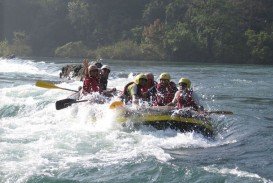
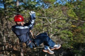
Rafting in Ash River, Clarens,
Free State South Africa
Grade:
2-4
Distance:
17km/10.5mi
The Free State is situated on the flat boundless plains in the heart of South Africa. Known locally as the "breadbasket" of South Africa, it is an agricultural city and most of its land lies at 1000 m/3281 ft above sea level. It is the land of rugby, sunny skies and characterized by a continental climate, with warm to hot summers and cool to cold winters.
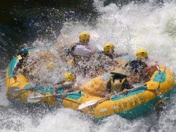
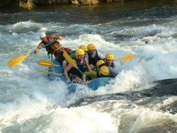
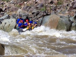
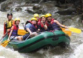
The Ash River, just outside Clarens, offers the best white water rafting conditions in South Africa thanks to the Lesotho Highlands Water Project which has a great deal of influential effect. Experience the splash and feel the adrenalin rush of a life time!! White water rafting here is an all year round adventure and boast 17 rapids.
Graded between 2-4, it covers a distance of 17 km/10.5 mi and is a guided tour with spectacular scenic vegetation and magnificent bird-life. Age limit here is from 6 to 106 years-old and the minimum pax is 2.
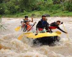
Victoria Falls, in Zambia, is the borderline between the Upper and the Middle Zambezi River. Within few kilometers below, the river flows through the Batoka Gorge, where the most challenging whitewater rafting can be performed.
False Bay is a body of water characterized by Cape Hangklip and Cape Peninsula, located in the southwest of South Africa. The bay is 30 km/18.7 mi wide, offering a Mediterranean climate with warm, dry summers and wet damp winters. The east and western shores of the bay are rocky and mountainous with visible peaks rising from the waters, while the northern side comprises a long, curving beach.
Salt River is a stream in the US in Arizona. This river is the largest tributary of Gila River. Today, this natural heritage is visited by many tourists.
Bali is a province in Indonesia with a few neighboring islands including the Isle of Bali. The island of Bali lies at about 8 degrees/ 0.13 radians on the south of equator and at 3.2 km/1.9 mi from Java. It is surrounded by coral reefs with white sand beaches on the south and black sand beaches on the north and the west of the island.
Goa is one of the most visited and famous places in India since the 60's. Located on the West Coast of the country and fronted by the Arabian Sea, it boasts an amazing coastline with sandy beaches, as well as rich landscapes and tropical forests. Once a Portuguese colony, Goa is an interesting blend of cultures and architectures and is considered to be one of the hotspot destinations in the world for both party goers and spiritual seekers.
Java is the 5th largest island in Indonesia and the world's most populous as well. It acts as Indonesia's center of cultural and economic activity. Java is divided into four provinces, West Java, East Java, Central Java and Banted plus two additional special regions, Jakarta and Yogyakarta. Java is almost entirely of volcanic origin and lies between Sumatra to the west and Bali to the east.
The Free State is situated on the flat boundless plains in the heart of South Africa. Known locally as the "breadbasket" of South Africa, it is an agricultural city and most of its land lies at 1000 m/3281 ft above sea level. It is the land of rugby, sunny skies and characterized by a continental climate, with warm to hot summers and cool to cold winters.
The Free State is situated on the flat boundless plains in the heart of South Africa. Known locally as the "breadbasket" of South Africa, it is the agricultural city and most of its land is at 1000 m/3281 ft above sea level. It is the land of rugby, sunny skies and characterized by a continental climate, with warm to hot summers and cool to cold winters.
The Free State is situated on the flat boundless plains in the heart of South Africa. Known locally as the "breadbasket" of South Africa, it is the agricultural city and most of its land is at 1000 m/3281 ft above sea level. It is the land of rugby, sunny skies and characterized by a continental climate, with warm to hot summers and cool to cold winters.