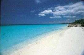
Gordons Bay, Clovelly
Clovelly is a beachside suburb of Sydney, at about 8 km/4 mi in the south-east of Sydney's CBD (Central Business District).
Home  > WATER SPORTS  > Scuba Diving  > Zingara Wreck, Puerto Plata Area
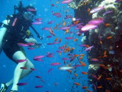
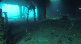
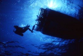
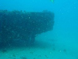
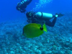
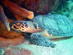
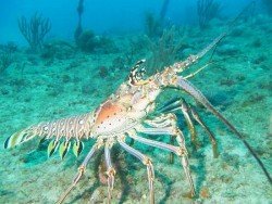
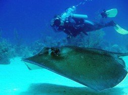
Dominican Republic offers a large variety of dive sites. Zingara Wreck is an interesting dive site, not to be missed. This medium sized freighter was sunk in 1992 on the northern coast of Dominican Republic. It is also east of Sosua, a small town in the Puerto Plata province. The wreck is lying at a depth of 36 m/118.1 ft. While being located in the open ocean, the spot has an interesting marine life. Stone fish, moray eels, barracuda, just to mention some. Generally, it is a wreck seriously affected by currents, because of its location. The underwater visibility fluctuates between 10 m/32.8 ft and 30 m/98.4 ft.
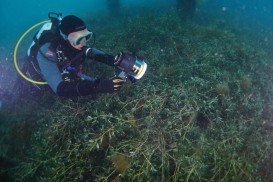
The temperature of the water is pretty high. It actually averages 28°C/82.4°F. Moreover, the temperature is about 25°C/77°F all year round. Dominican Republic has a tropical climate. The wet season usually lasts from November to January on the northern coast. Zingara Wreck is a dive spot feasible to all levels of divers, as previous experience is not needed.
Finally, contact your diving school, because you may have the opportunity to try another spot, since each dive spot is very close to many others.
Clovelly is a beachside suburb of Sydney, at about 8 km/4 mi in the south-east of Sydney's CBD (Central Business District).
The Turks and Caicos Islands lie in the Lucayan Archipelago and are a British Overseas Territory consisting of eight islands: West Caicos, Providenciales, East Caicos, South Caicos, North and Middle Caicos, Grand Turk and Saly Cay. Only East and West Caicos are uninhabited. Apart from a superb tourist destination, they are also well-known as an offshore financial center. The climate of the islands is classified as marine tropical, providing relatively consistent temperatures throughout the year.
Cronulla is a beach-side suburb in southern Sydney, at about 26 km/16 mi in the south of Sydney's CBD (Central Business District). Cronulla lies on a peninsula, between Botany Bay on the north and Port Hacking on the south. Cronulla is a popular tourist location and attracts many beach enthusiasts.
Watamu Beach is located at 120 km/74 mi in the north of Mombasa and 28 km/17 mi in the south of Malindi, the nearest big town. The shoreline of this area consists of white sandy beach and offshore corals, forming three bays, namely Watamu bay, Turtle bay and Blue Lagoon. The bay is protected by a coral reef at almost 0.5 km/546.81 yd off the shore.
Ushuaia is the capital city of the Tierra del Fuego province in Patagonia, commonly referred as the southernmost city in the world, being also an important naval base. It is located in a wide open bay on the south coast of Isla Grande de Terra del Fuego and bordered in the north by the Martial mountain range.
Salt Island belongs to the British Virgin Islands, located in the Caribbean Sea. It is standing in the eastern side of Puerto Rico and in the southern of Tortola, the largest island of the British Virgin Islands. Road Town is the island complex capital and is situated in Tortola.
The island of Hispaniola is shared by two countries, the Dominican Republic nation and the Haiti nation. The island is situated in the northern Caribbean Sea. Santo Domingo, the capital city of Dominican Republic is standing in the south.
Dominican Republic is standing on the eastern side of Hispaniola Island. This Caribbean island is divided into two nations, the Dominican Republic and Haiti. The country of Haiti is standing on the western side of Hispaniola. Dominican Republic is also west of Puerto Rico and south-east of Cuba. Its capital is Santo Domingo.
The Dominican Republic is located on the island of Hispaniola, in the northern Caribbean Sea. The Haiti nation is standing on the western side of the same island. Santo Domingo, the capital city is situated on the southern side of Dominican Republic.
Saona Island is a tropical island that is situated on the southeast tip of the Dominican Republic and is also part of East National Park. It is considered by many to be the earthly paradise. In fact, it is a very popular destination for tourists from all over the world. The island is not accessible by car or airplane, but this is not a problem, as many organised excursions are daily on offer.
The Dominican Republic is a country on the Hispaniola island. The western third of the island belongs to Haiti nation. After Saint Martin, Hispaniola is the second island in the Caribbean that is shared by two countries. Dominican Republic is located on the northern side of the Caribbean Sea.
Hispaniola Island is divided into two nations. Haiti is standing on the western side of the island, while Dominican Republic is located on the eastern side. The island is lying in the northern Caribbean Sea. Dominican Republic is situated on the south-eastern side of Cuba, on the eastern side of Jamaica and on the western side of Puerto Rico.
Hispaniola Island is standing in the northern Caribbean Sea. It is situated south-east of Cuba and west of Puerto Rico. Hispaniola is divided into 2 nations, as Saint Martin too. Dominican Republic is located on the eastern side of the island and Haiti lies on the western side of Hispaniola. Santo Domingo is the capital of Dominican Republic.
