
South Australian Wreck, Wardang Island
Wardang Island, also known as Wauraltee Island, is a small island of 20 km²/7.7 mi² in the Spencer Gulf, at 11 km/6 mi in the northwestern coast of Port Victoria on the Yorke Peninsula, South Australia.
Home > WATER SPORTS > Scuba Diving > Airport Wall, Sosua
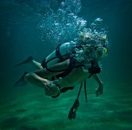
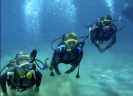
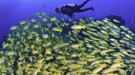
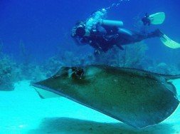
Dominican Republic is a popular destination for divers from all over the world. More than 50 dive sites are dispersed along the coast of this country. Even if you are not a dive lover, you will be seduced by the enthusiasm of those who have already tried diving and you will certainly desire to experience the feeling. Well, Airport Wall is an interesting scuba diving site for all levels of divers.
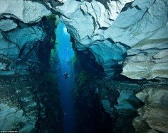
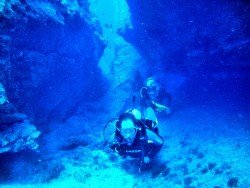
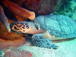
This dive spot is located in the north-western Sosua, in the province of Puerto Plata. It is actually a reef that follows the coastline in front of the airport of Puerto Plata. The average depth of the site is 18 m/59.1 ft, while its maximum depth is 36 m/118.1 ft. Divers have the chance to swim through little caverns and tunnels, meet many kinds of corals and of course an array of marine life, like barracudas, eagle rays and reef sharks.
Generally the underwater visibility ranges from 10 m/32.8 ft to 30 m/98.4 ft. The visibility depends on the weather conditions. Moreover this dive spot is exposed to currents, as it stands in the open ocean. Furthermore the average temperature of the water is 28°C/82.4°F.
If you visit Dominican Republic, don’t miss this amazing opportunity. It will be a wonderful experience that you’ll definitely wanna live again!
Wardang Island, also known as Wauraltee Island, is a small island of 20 km²/7.7 mi² in the Spencer Gulf, at 11 km/6 mi in the northwestern coast of Port Victoria on the Yorke Peninsula, South Australia.
Seawolves Cove is a rocky spot for scuba diving, located in Marion Bay, Yorke Peninsula. Minimum winter temperatures average around 4°C/39.2°F and the maximum can reach 40°C/104°F during summer.
Richardson's beach is located in Hilo, Hawaii, which is the most populated city of the island. Hilo is an old fashioned bay front town, with tropical rain forest climate all year long and home of the Tsunami Museum, dedicated to the understanding of the 1946 Pacific Tsunami.
Myrtle Beach is a coastal city on the east coast of the United States, in Horry County, South Carolina. Thanks to the city's warm subtropical climate and amazing beaches, this spot attracts approximately 14 million visitors each spring, summer and fall. Myrtle Beach has a humid subtropical climate with abundant sunshine all the year round.
Trinidad and Tobago is an island country that is situated just off the coast of northeastern Venezuela. Both Trinidad and Tobago islands surprise visitors with their unspoiled natural beauty that is not found in most of the other Caribbean islands. The climate here is classified as tropical with two seasons annually, the dry and rainy season and the winds are usually influenced by the northeast trade winds. The islands are known not only for their beautiful sandy beaches, but also for their carnivals.
Pulau Tiga is located at 48 km/30 mi in the south of Kota Kinabalu and became well known due to the "Survivor" series, hosting the setting of "Survivor Borneo", the first American season of the show. Scuba diving in Pulau Tiga is open to all levels of divers and is a prime location for macro lovers and underwater photography. The spot is believed to have been formed by the eruption of several mud volcanoes and is at 100 m/328 ft above sea level.
The Dominican Republic is a country on the Hispaniola island. The western third of the island belongs to Haiti nation. After Saint Martin, Hispaniola is the second island in the Caribbean that is shared by two countries. Dominican Republic is located on the northern side of the Caribbean Sea.
Dominican Republic is standing on the eastern side of Hispaniola Island. This Caribbean island is divided into two nations, the Dominican Republic and Haiti. The country of Haiti is standing on the western side of Hispaniola. Dominican Republic is also west of Puerto Rico and south-east of Cuba. Its capital is Santo Domingo.
The Dominican Republic is located on the island of Hispaniola, in the northern Caribbean Sea. The Haiti nation is standing on the western side of the same island. Santo Domingo, the capital city is situated on the southern side of Dominican Republic.
Hispaniola Island is divided into two nations. Haiti is standing on the western side of the island, while Dominican Republic is located on the eastern side. The island is lying in the northern Caribbean Sea. Dominican Republic is situated on the south-eastern side of Cuba, on the eastern side of Jamaica and on the western side of Puerto Rico.
Saona Island is a tropical island that is situated on the southeast tip of the Dominican Republic and is also part of East National Park. It is considered by many to be the earthly paradise. In fact, it is a very popular destination for tourists from all over the world. The island is not accessible by car or airplane, but this is not a problem, as many organised excursions are daily on offer.
Hispaniola Island is located in the northern Caribbean Sea. It is standing on the western side of Puerto Rico and south-east of Cuba. Hispaniola is divided into 2 nations. Dominican Republic is located on the eastern side of the island and Haiti on the western side. The capital of Dominican Republic is Santo Domingo.
The island of Hispaniola is shared by two countries, the Dominican Republic nation and the Haiti nation. The island is situated in the northern Caribbean Sea. Santo Domingo, the capital city of Dominican Republic is standing in the south.