
Hull Creek, Sonora
Sonora Pass is located near Pinecrest, Tuolumne County, California, USA. It is off of Highway about 60 mi/96.5 km east of Sonora.
Home > MOUNTAIN SPORTS > Mountain Biking > Mount Baldy, San Bernardino
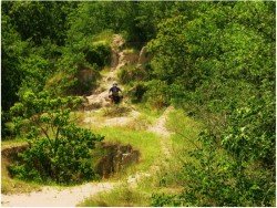
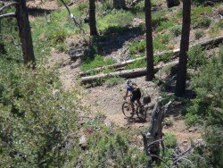
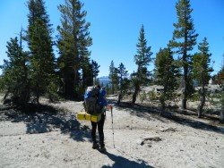
Mount Baldy is perfect for mountain biking. It is an out and back round trip, up and down Mount Baldy about 9.6 mi/15.45 km long. The first 3.6 mi/5.7 km respond to a moderately steep rise of 1600 ft/487.7 m to the Baldy Notch. After a steep climb of 685 ft/208.8 m of over 1.2 mi/1.9 km, you will get close to the top of Thunder Mountain.
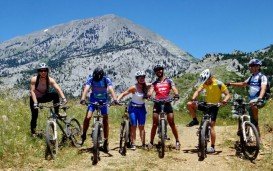
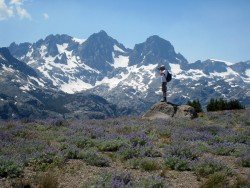
The first 1.5 mi/2.4 km is an one land paved road. Then it changes to a hard packed, four wheel drive road in rather good condition, that has some rocky sections. You must have moderate skills and a lot of strength. After arriving at the summit of Thunder Mountain, you can enjoy the breathtaking view of the surrounding mountain valleys.
Elevation gain of the route is 2285 ft/696.5 m. Skill level is regarding aerobic difficult and as for technical, moderately difficult. Trailhead elevation is 6200 ft/1890 m and top elevation 8485 ft/2586 m. Best season is late spring through fall.
It is suggested to have the appropriate maps with you like USGS Mount San Antonio and Telegraph Peak. Local Contacts are Angeles National Forest and San Gabriel River Ranger District.
Sonora Pass is located near Pinecrest, Tuolumne County, California, USA. It is off of Highway about 60 mi/96.5 km east of Sonora.
Lowell Dracut Tyngsboro State Forest is a forest, which covers the district of three towns in Massachusetts; Lowell, Dracut and Tyngsborough.
Saint Ignace, located in Michigan's Upper Peninsula, is the second-oldest city founded by Europeans in Michigan and the third oldest continuously inhabited city in the U.S. Inhabited by Native Americans, Europeans and rich in history, it is mostly known for its ferry service to Mackinac Island and as being the home to Straits State Park. Furthermore, the Huron Boardwalk, a number of waterfront parks, the virgin beaches and the St. Ignace – Trout Lake Trail make St. Ignace a great vacation destination for all.
Adelaide, the liveliest city in Australia, is the capital of South Australia state. It is situated on the Adelaide Plains and more specifically at the north side of Fleurieu Peninsula. It is built next to Torrens River and is surrounded by the Mount Lofty Ranges and the Gulf St Vincent. Fox Creek is situated at 34.8 km/21.6 mi from Adelaide CBD.
The beautiful city of Sedona straddles the county line between Coconino and Yavapai counties in the northern Verde Valley region in Arizona. Sedona is a place that offers many cultural sites, recreational opportunities, impressive landscapes and that's why it attracts about 4 million visitors every year.
Tamarack Lodge Resort is located in Mammoth Lakes, near Mammoth Mountain, in California’s eastern Sierra about 100 mi/161 km south of Nevada State line Mono County, California, USA.
Lake Havasu is situated behind Parker Dam on the Colorado River, just on the border that joins California with Arizona.
Lake Havasu is situated behind Parker Dam on the Colorado River, just on the border that joins California with Arizona. On the eastern shore of the lake lies Lake Havasu City.
Tamarack Lodge Resort is located in Mammoth Lakes, near Mammoth Mountain, in California’s eastern Sierra about 100 mi/161 km south of Nevada State line Mono County, California, USA.
Ocean Beach is located in San Diego on the Southern coast of California.
Alta Sierra (aka Shirley Meadows) is a very small ski resort located in Wofford Heights, in the Greenhorn Mountain, at about 60 mi/96.6 km northeast from Bakersfield, California, USA.
Alta Sierra (aka Shirley Meadows) is a very small ski resort located in Wofford Heights, in the Greenhorn Mountain, at about 60 mi/96.5 km northeast from Bakersfield, California, USA.
Mammoth Mountain is located in California’s eastern Sierra, at 100 mi/161 km south of Nevada State line and 50 minutes from the Eastern Gate of Yosemite National Park.
Lake Havasu is situated behind Parker Dam on the Colorado River, just on the border that joins California with Arizona.