Clavey River, Sonora
Sonora Pass is located near Pinecrest, Tuolumne County, California, USA. It is off of Highway about 60 mi/96.5 km east of Sonora.
Home > MOUNTAIN SPORTS > Extreme Hiking / Hiking > Mount Shasta, Redding
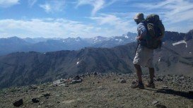
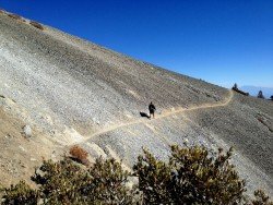
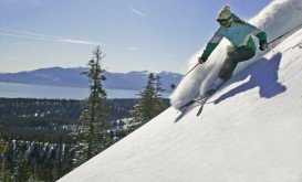
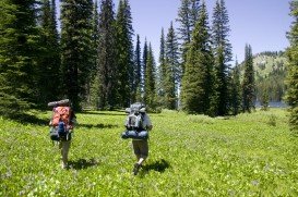
Mount Shasta is inside Shasta – Trinity National Forest and the second highest volcano in the Cascade Range. It is the perfect place for hiking. The trails offer spectacular scenery and occasionally a sight of many wild animals such as bears, deer and eagles.
Most trails are round trips, but trails, listed as strenuous are better to be hiked, only if you are in a very good physical condition. You can find short hikes (15-45 minutes long). Some of the short hikes are John Everitt Vista Point, an easy 20 minutes and 0.5 mi/0.8 km hike, with 5000 to 5100 ft/1524 to 1554 m elevation and Panther Meadow Loop, an easy 45 minutes and 1.5 mi/2.4 km hike, with 7500 to 7900 ft/2286 to 2408 m elevation.
Medium hike (1-2 hours) is Old Ski Bowl Trail, an easy 1 hour (varies), 1 mi/1.6 km hike, with 7800 ft/2377 m elevation. Longer hikes (2 hours or more) are Bunny Flat Trail, a moderate to strenuous 3-4 hours, 4.5 mi/7.2 km hike, with 6900 to 7900 ft/2103 to 2408 m elevation, Send Flat Trail, a strenuous 3 hours, 4 mi/6.4 km hike, with 6800 to 7900 ft/2073 to 2408 m elevation, Grey Butte Trail, a moderate 3 hours, 3 mi/4.8 km trail, with 7600 to 8000 ft/2316 to 2438 m elevation and Squaw Meadows Trail, a 4-5 hours, 4 mi/6.4 km trail, with 7600 to 7800 feet/2316 to 2377 m elevation.
There are also day hikes on Horse Camp, Whitney Falls and Clear Creek. Hike season starts from early April until late October, depending on weather conditions and snow.
Sonora Pass is located near Pinecrest, Tuolumne County, California, USA. It is off of Highway about 60 mi/96.5 km east of Sonora.
Wenatchee is the largest city of Chelan County, located in North Central Washington and lies on the west side of the Columbia River. The city is also known as the Apple Capital of the world, due to the valley's apple cultivations.
Kahului is located in Maui Island on Hawaii and is the largest city of the Island. It is considered to be a shopping destination because there are several major stores and malls.
Volcano National park is located at 30 mi/48 km in the southwest of Hilo Town in Hawaii. The park was established in 1916 and is a combination of unique ecosystems and diverse environments that range from the sea to the summit of the world's biggest volcano, Mauna Loa, as well as Kilauea which is the world's most active volcano.
Rogue River is situated in southwestern Oregon, near the city of Grants Pass.
The mountain resort of Vall de Nuria is located in the Eastern Pyrenees of the municipality of Queralbs. There is no road leading there, only by train or the old footpath - mule track. Enjoy the spectacular mountain landscape using an unusual transport, the rack railway.
Bear Valley is a ski area located near Angels Camp, on highway 4, between Lake Tahoe and Yosemite, approximately 3 hours southeast of Sacramento, California, USA.
Kirkwood Mountain Resort is a year round resort in Kirkwood, south of Lake Tahoe, in El Dorado County, California, USA. Kirkwood is at 33 mi/53 km south of South Lake Tahoe, on State Route 88 and it is surrounded by El Dorado National Forest.
Bear Valley is a ski area located near Angels Camp, on highway 4, between Lake Tahoe and Yosemite, approximately 3 hours southeast of Sacramento, California, USA.
Lake Talawa is located in Talawa Dunes State Park, north of Crescent City, Del Norte County, California, USA.
Bear Valley is a ski area located near Angels Camp, on highway 4, between Lake Tahoe and Yosemite, approximately 3 hours southeast of Sacramento, California, USA.
South Lake Tahoe is located on the California–Nevada border, El Dorado County, California, USA.
Big Lagoon is located at 7 mi/11.3 km north of Trinidad, Humboldt County, California, USA.

