Leavitt Meadow, Sonora
Sonora Pass is located near Pinecrest, Tuolumne County, California, USA. It is off of Highway about 60 mi/96.5 km east of Sonora.
Home > MOUNTAIN SPORTS > Backpacking / Trekking > Bull Run Lake, Angels Camp
Near Bear Valley, on Highway 4 lies Lake Alpine about 50 mi/80.5 km from Angels Camp. Elevation of the lake is 7300 ft/2225 m. If you visit Lake Alpine, you should definitely go backpacking in Bull Run Lake. The trail starts at Stanislaus Meadows. Parking is about 3 mi/4.8 km east of the lake, on Highway 4.
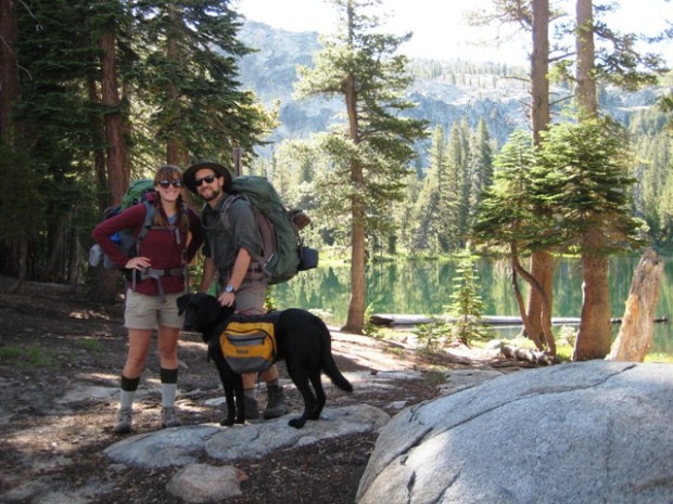
The trail is easy and about 7 mi/11.26 km round trip. It is a lovely lake and especially in late spring or early summer you can enjoy the magnificent view of the majestic, snowy mountains. You can camp around the lake. Elevation gain of the trail is about 1000 to 1500 ft/304.8 to 457.2 m.
Many parts of the trail are rocky and uphill, but the entire trail is well marked. It is recommended to be in a good physical shape, if you want to take that route.
Sonora Pass is located near Pinecrest, Tuolumne County, California, USA. It is off of Highway about 60 mi/96.5 km east of Sonora.
Glenorchy is a small settlement, situated in Otago region at South Island in New Zealand. It lies on the northern side of Lake Wakatipu and is surrounded by Richardson and Humboltd Ranges.
Hell's Gate is located in the South of Lake Naivasha and at about 90 km/55 mi in the northwest of Nairobi City. It covers an area of 68 km²/26.25 mi² and is at 1900 m/6233 ft above sea level. Some of the highlights are the Fischer's tower, Central tower and Hell's Gate gorge. Although there is a wide variety of wildlife, it is famous for a variety of bird species including vultures, verreaux's eagles, swifts and augur buzzards.
In the surroundings of Lake Garda, several types of trekking or/and Nordic walking can be practiced easily in a very pleasant and relaxed way.
Sonora Pass is located near Pinecrest, Tuolumne County, California, USA. It is off of Highway about 60 mi/96.5 km east of Sonora.
Mammoth Mountain is located in California’s eastern Sierra, at 100 mi/161 km south of Nevada State line and 50 minutes from the Eastern Gate of Yosemite National Park.
Mount Shasta is located in northern California, east of Interstate 5 along SR89, between Mount Shasta city and McCloud city, California, USA.
Soda Springs ski resort is located near Soda Springs, Nevada County, California, USA. Soda Springs ski resort is just off of Highway 80, near the Donner Summit.
Mammoth Lakes is located near Mammoth Mountain, in California’s eastern Sierra about 100 mi/161 km south of Nevada State Line, 9 mi/14.5 km northwest of Mount Morrison, at an elevation of 7880 ft/2402 m, Mono County, California, USA.
Mount Shasta is located in northern California, east of Interstate 5 along SR89, between Mount Shasta city and McCloud city, California, USA.
Bear Valley is a ski area located near Angels Camp, on highway 4, between Lake Tahoe and Yosemite, approximately 3 hours southeast of Sacramento, California, USA.
Sonora Pass is located near Pinecrest, Tuolumne County, California, USA. It is off of Highway about 60 mi/96.5 km east of Sonora.