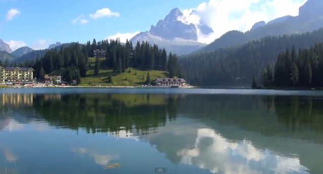
Charakhusa Valley (K7), Karakoram Park
The Charakhusa, also known as K7 Valley belongs to the Karakoram range of the country of Pakistan. The valley is popular due to its perfect conditions for mountaineering high peaks.
Home > MOUNTAIN SPORTS > Mountaineering > Mount Shasta, Redding
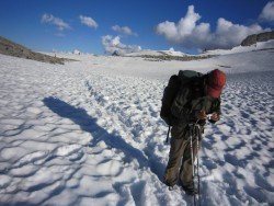
Mount Shasta is inside Shasta – Trinity National Forest and the second highest (14163 ft/4317 m) volcano in the Cascade Range. Mount Shasta is the perfect place to test your physical abilities and determination in mountaineering, by climbing the second highest volcano in the US. The mountain is a veritable utopia for mountaineers.
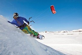
It offers a magnificent vertical relief, reliably sunny weather and relatively mild terrain. The weather offers prime climbing conditions. You can start your three day course at the base of 8000 ft/2438 m and be taught the basics for beginners in skiing or snowboard mountaineering.
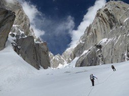
The course is about how to use ski crampons, ice ax self arrest, climb with skins etc. When the training is over, the students wake up at 2-3 a.m. and zigzag about 5000 vertical ft/1524 m up to the peak, in a confusion of boulders, big enough to scramble on top and in breathtaking views, stretching around for 125 mi/201.1 km.
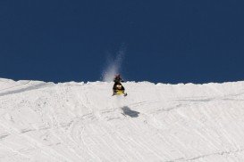
You will be rewarded by being on one of the longest, continual ski descents in the Lower 48. You can also ride a 7000 vertical ft/2134 m, down a consistent 35-45 degree slope to the trailhead. It is highly recommended to plan your trip carefully, carry crampons and ax to traverse hard snow and ice fields.
You should better arrange having a guide with you or mountaineering instruction in safe backcountry skills. Permits are mandatory, so purchase them along with maps of the area from Mt. Shasta District Ranger Station.
The Charakhusa, also known as K7 Valley belongs to the Karakoram range of the country of Pakistan. The valley is popular due to its perfect conditions for mountaineering high peaks.
Chogolisa, also known as Bride Peak, is a mountain that belongs to the Karakoram range of Pakistan. The mountain lies near the Baltoro Glacier, situated in the Concordia region that is home to some of the highest peaks of the world.
Gasherbrum is a pretty remote group of peaks, situated at the northeastern end of the Baltoro Glacier and placed in the Karakoram range of the Himalayas, on the border of the Gilgit - Baltistan controlled by Pakistan and the Chinese-administrated Shaksgam Valley. This massif contains three of the 8000 m/26246 ft high peaks of the world.
Muztagh Ata, also known as Muztaghata, is the second highest mountain of the range, forming the northern edge of the Tibetan Plateau. Its name literally means “ice-father-mountain” and is one great mountaineering destination.
Gasherbrum is a pretty remote group of peaks, situated at the northeastern end of the Baltoro Glacier and placed in the Karakoram range of the Himalayas, on the border of the Gilgit - Baltistan controlled by Pakistan and the Chinese-administrated Shaksgam Valley. This massif contains three of the 8000 m/26246 ft high peaks of the world.
Glenorchy is a small settlement, situated in Otago region, in the South Island of New Zealand. It lies on the northern side of Lake Wakatipu and is surrounded by Richardson and Humboltd Ranges.
Crescent South Beach is located near Crescent City, Del Norte County, California, USA.
Squaw Valley Ski Resort is located in Olympic Valley, California, USA. It is one of the largest ski areas in the US after Heavenly and was the site of the 1960 Winter Olympics.
Homewood Mountain Ski Resort is located a few miles south of Tahoe City near Homewood, on the west side of Lake Tahoe, California, USA.
Sonora Pass is located near Pinecrest, Tuolumne County, California, USA. It is off of Highway about 60 mi/96.5 km east of Sonora.
Yosemite National Park is located near Mariposa, California, USA.
Sonora Pass is located near Pinecrest, Tuolumne County, California, USA. It is off of Highway about 60 mi/96.5 km east of Sonora.
Heavenly Mountain Resort is located near the city of South Lake Tahoe, on the California-Nevada border, El Dorado County, California, USA.
Sonora Pass is located near Pinecrest, Tuolumne County, California, USA. It is off of Highway about 60 mi/96.5 km east of Sonora.