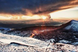
Bear Valley is a ski area located near Angels Camp, on highway 4, between Lake Tahoe and Yosemite, approximately 3 hours southeast of Sacramento, California, USA.
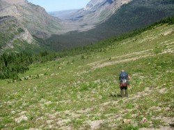
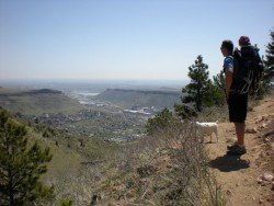
Near Bear Valley lies Ebbetts Pass, which is perfect for hiking. Day hikes can vary from unstrained, quarter mile hikes to full day excursions on strenuous mountain peaks. One of the best hikes at Ebbetts Pass is Pacific Crest Trail. There are two trail paths.
The first one is south of Noble Lake, which is a 3.5 mi/5.6 km, one way mountain trail with 500 ft/152.4 m descent elevation, changeable and 500 ft/152.4 m climb. The trailhead is at the parking lot. The trail drops down to 500 ft/152.4 m at Noble Creek and then gains back its elevation on its way up to Noble Lake.
The second trail is north of Reynolds Peak. It is a 4 mi/6.4 km, one way mountain trail with 100 ft/30.5 m up and down elevation. The trailhead is along the Highway, east of Ebbetts Pass summit. While hiking, you will pass the Kinney Lakes and don’t miss walking next to the rugged volcanic slopes of Raymond and Reynolds Peaks.