
Uguiaban Bridge, Cagayan de Oro River
Cagayan River also known as Cagayan de Oro River is a well-known river, draining the north central part of the island of Mindanao in the Philippines.
Home  > WATER SPORTS  > Kayaking  > Big Lagoon, Trinidad
With the large sand barrier that separates the lagoon from the ocean, Big Lagoon is a paradise. If you are willing to walk far enough, you can find yourself all alone at the spot. It is a swimming friendly beach with shallow areas of the lagoon especially near the boat ramp.
Water temperature is quite pleasant. The dangerous Pacific surf is about 300 ft/91.4 m away, so it is rather safe to swim. The water in the Lagoon is slightly brackish. Lots of plants and animals are inhabitants of the Lagoon. Pelicans come in summer to bathe and some wading shore birds are living on the side of the sand bar.
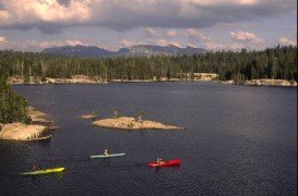
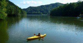
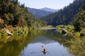
The rugged northeast coast is covered by old-growth redwood and Sitka spruce forest. On south shore, water along the lagoon is shallow and the banks are densely wooded and overgrown. Big Lagoon is perfect for kayaking. Just make sure to take care of your safety and also to protect this unique place.
Before entering water, check out for toxic blue – green algae. Kayakers should check out Kayak’s Zak website to be informed about kayaking in Big Lagoon.
Cagayan River also known as Cagayan de Oro River is a well-known river, draining the north central part of the island of Mindanao in the Philippines.
Glenorchy is a small settlement, situated in Otago region in the South Island, New Zealand. It lies on the northern side of Lake Wakatipu and is surrounded by Richardson and Humboltd Ranges.
Close to the lake of Caumecon, Saint Martin du Puy is a small rural community, gathering eight villages in Burgundy of central France. On the spot, there is one of the best canoe and kayaking places in France, the river "Le Chalaux", where national and international competitions are held quite regularly.
Epirus is a geographic and administrative region, located in northwestern Greece. It is considered to be the region with the more rainfall than any other part of the country. In fact, Epirus offers imposing landscapes of outstanding natural beauty as well as a wide variety of fauna and flora.
L'Argentière-la-Bessée is a commune of the Hautes-Alpes department in the Alps in southeastern France. The spot is situated next to the Durance river, which is used for kayaking and other water sports. The town is located on the edge of the Ecris National Park.
Bear Valley is a ski area located near Angels Camp, on highway 4, between Lake Tahoe and Yosemite, approximately 3 hours southeast of Sacramento, California, USA.
Lake Shasta Caverns is located in northern California, east of Interstate 5 along SR89, between Mount Shasta city and McCloud city, California, USA.
Mount Shasta is located in northern California, east of Interstate 5 along SR89, between Mount Shasta city and McCloud city, California, USA.
Crescent South Beach is located near Crescent City, Del Norte County, California, USA.
Klamath River is a beautiful beach near Klamath, Del Norte County, California, USA.
Mount Shasta is located in northern California, east of Interstate 5 along SR89, between Mount Shasta city and McCloud city, California, USA.