

ADD COMMENT
Rogue River, Grants Pass
/
Oregon USA
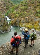
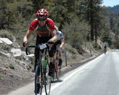
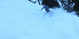
Rogue River is situated in southwestern Oregon, near the city of Grants Pass.
In 2012 it joined forces with Alpine Meadows, offering access to 6000 ac/24.28 km², 43 lifts and over 270 trails. Squaw Valley is the perfect place for hiking. You can choose from a variety of trails. Ride the Aerial Tram to High Camp. Climb to the weathered abutments at the top of Squaw Peak and make a visit to the historic Watson Monument at the Emigrant Park.
Another option is to meander through the beautiful meadows, feel the intoxicating smell of the wildflowers and enjoy the panoramic vistas of breathtaking landscapes of Squaw’s upper mountain. Trails are easy to moderate and moderate to difficult.
Easy to moderate trails are free guided hikes about 1.5 mi/2.4 km long, High Camp Loop about 1 mi/1.6 km long, High Camp to the top of the Gold Coast Chairlift about 1 mile long and High Camp to the top of the Newport Chairlift about 1.5 mi/2.4 km long and 460 ft/140.2 m elevation gain.
Moderate to difficult trails are High Camp to the top of the Emigrant Chairlift about 1.5 mi/2.4 km long and 500 ft/152.4 m elevation gain, High Camp to the top of the Squaw Peak about 2.2 mi/3.5 km long and 600 ft/182.8 m elevation gain, High Camp to Shirley Lake & down Shirley Canyon about 4 mi/6.4 km long and Thunder Mountain Trail about 4.5 mi/7.2 km long.
Rogue River is situated in southwestern Oregon, near the city of Grants Pass.
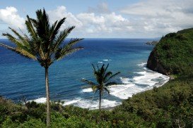
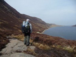
Pololu Valley is the Northernmost valley, forming the East coast of the Kohala Mountain after Waipio Valley. The valley goes at 420 ft/128 m downwards and it ends at a beautiful beach with black sand.
Wenatchee is the largest city of Chelan County, located in North Central Washington and lies on the west side of the Columbia River. The city is also known as the Apple Capital of the world, due to the valley's apple cultivations.
Honokaa town is located in the Hamakua Coast, at 40 mi/64 km in the north of Hilo. The area is a historic district of Big Island in Hawaii because the town's economy was once based on sugar production from the Hamakua Sugar Company, until 1994.
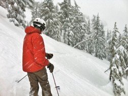
Bear Valley is a ski area located near Angels Camp, on highway 4, between Lake Tahoe and Yosemite, approximately 3 hours southeast of Sacramento, California, USA.
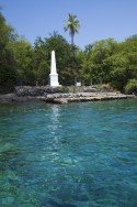
In the North side of Kealakekua Bay, close to HI-11/ Hawaii Belt Rd, lies the monument of British explorer Captain Cook, who was killed in 1779. The road that leads to the monument is accessible by foot only.
Bear Valley is a ski area located near Angels Camp, on highway 4, between Lake Tahoe and Yosemite, approximately 3 hours southeast of Sacramento, California, USA.
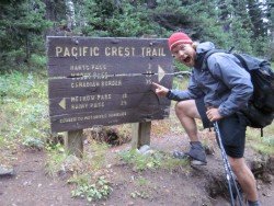
Sonora Pass is located near Pinecrest, Tuolumne County, California, USA. It is off of Highway about 60 mi/96.5 km east of Sonora.
Sonora Pass is located near Pinecrest, Tuolumne County, California, USA. It is off of Highway about 60 mi/96.5 km east of Sonora.
Sonora Pass is located near Pinecrest, Tuolumne County, California, USA. It is off of Highway about 60 mi/96.5 km east of Sonora.
Sonora Pass is located near Pinecrest, Tuolumne County, California, USA. It is off of Highway about 60 mi/96.5 km east of Sonora.
Mount Shasta is located in northern California, east of Interstate 5 along SR89, between Mount Shasta city and McCloud city, California, USA.
Badger Pass Ski Area is a small ski area which is located in Yosemite National Park, near Mariposa, California, USA.
Kirkwood Mountain Resort is a year round resort in Kirkwood, south of Lake Tahoe, in El Dorado County, California, USA. Kirkwood is at 33 mi/53 km south of South Lake Tahoe, on State Route 88 and it is surrounded by El Dorado National Forest.


