ADD COMMENT
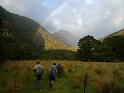
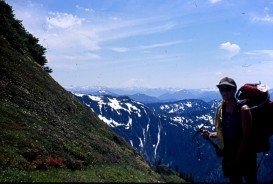
Kepler Track, Te Anau
/
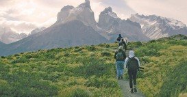
Southland New Zealand
Te Anau is a small town, situated in Fiordland region, in the South Island of New Zealand.
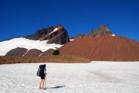
Mount Shasta is inside Shasta – Trinity National Forest and the second highest volcano in the Cascade Range. On the west of Mount Shasta, Mount Eddy dominates the mountain range across the valley. It is a conifer forest with granite rocks, alpine lakes and many small streams, offering a different backpacking experience.
The trails are divided to short and medium. Short trails (15-45 minutes) are Box Canyon Dam and Trail, a ¾ mile trail, offering a wonderful view of the canyon and Castle Shore Trail, an easy ½ hour, 5 mi/8 km trail, with 6400 ft/1951 m elevation.
A medium hike (1-2 hours) is Castle Lake Trail, a 2-3 hour, 3 mi/4.8 km trail, with 6000 to 6200 ft/1829 to 1890 m elevation, which is strenuous at first and then moderate rocky path. When you pick a camping point, make sure that it has adequate water runoff and use plastic under your tent to stay dry.
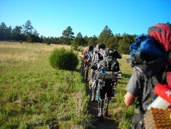
If you go backpacking on early spring, prefer to camp on snow than on fragile damp areas of earth. Try to use an already used camping spot, so you won’t expand camping area. Watch out for bears, they are present in the wilderness, so hang your food away from the camp.
If you want to burn a campfire, do it only in established fire pits. Best season to go backpacking is from early April until late October, depending on weather conditions and snow.

Te Anau is a small town, situated in Fiordland region, in the South Island of New Zealand.
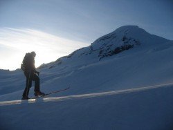
Sonora Pass is located near Pinecrest, Tuolumne County, California, USA. It is off of Highway about 60 mi/96.5 km east of Sonora.
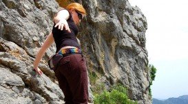
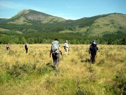
In the surroundings of Lake Garda, several types of trekking or/and Nordic walking can be practiced easily in a very pleasant and relaxed way.
Bear Valley is a ski area located near Angels Camp, on highway 4, between Lake Tahoe and Yosemite, approximately 3 hours southeast of Sacramento, California, USA.
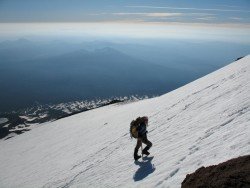
Mount Shasta is located in northern California, east of Interstate 5 along SR89, between Mount Shasta city and McCloud city, California, USA.
Bear Valley is a ski area located near Angels Camp, on highway 4, between Lake Tahoe and Yosemite, approximately 3 hours southeast of Sacramento, California, USA.
Badger Pass Ski Area is a small ski area which is located in Yosemite National Park, near Mariposa, California, USA.
Tamarack Lodge Resort is located in Mammoth Lakes, near Mammoth Mountain, in California’s eastern Sierra about 100 mi/161 km south of Nevada State line Mono County, California, USA.
Mammoth Lakes is located near Mammoth Mountain, in California’s eastern Sierra about 100 mi/161 km south of Nevada State Line, 9 mi/14.5 km northwest of Mount Morrison, at an elevation of 7880 ft/2402 m, Mono County, California, USA.
Bear Valley is a ski area located near Angels Camp, on highway 4, between Lake Tahoe and Yosemite, approximately 3 hours southeast of Sacramento, California, USA.
Bear Valley is a ski area located near Angels Camp, on highway 4, between Lake Tahoe and Yosemite, approximately 3 hours southeast of Sacramento, California, USA.
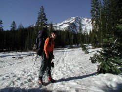
Mount Shasta is located in northern California, east of Interstate 5 along SR89, between Mount Shasta city and McCloud city, California, USA.
Sonora Pass is located near Pinecrest, Tuolumne County, California, USA. It is off of Highway about 60 mi/96.5 km east of Sonora.
Sonora Pass is located near Pinecrest, Tuolumne County, California, USA. It is off of Highway about 60 mi/96.5 km east of Sonora.