Luinne Bheinn, Knoydart
Knoydart, known as the Rough Bounds, lies in between the lochs Nevis and Hourn, in Lochaber Peninsula.
Home > MOUNTAIN SPORTS > Extreme Hiking / Hiking > Shirley Meadows, Wofford Heights
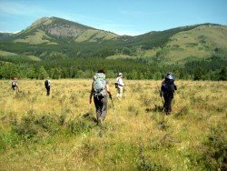
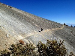
There is a great trail for hiking near Wofford Heights, offering pure fun and cool scenery. The trail is named Shirley Meadows Shebang. It has parts that are easy and some others that are very difficult. It is a downhill, known as one of many fabulous rides, located near Lake Isabella.
It contains a beautiful miniature forest and magnificent view of Lake Isabella. You can hike till the beginning of Shirley Peak. The trail is about 1 mile long and it has intermediate level of difficulty. At one point, you hike through a tunnel of enormous Manzanita trees.
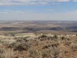
The general area is hot and dry, but this trail seems more cool and refreshing, maybe because it has an invigorating whoosh of a descent. Access to the trail is made by riding it up or by car. Length of the trail is 25.7 mi/41.4 km. Elevation gain is at 4250 ft/1295 m, trail-head elevation is at 2650 ft/807.7 m and top elevation is at 6600 ft/2012 m.
Knoydart, known as the Rough Bounds, lies in between the lochs Nevis and Hourn, in Lochaber Peninsula.
Mount Shasta is located in northern California, east of Interstate 5 along SR89, between Mount Shasta city and McCloud city, California, USA.
Volcano National park is located at 30 mi/48 km in the southwest of Hilo Town in Hawaii. The park was established in 1916 and is a combination of unique ecosystems and diverse environments that range from the sea to the summit of the world's biggest volcano, Mauna Loa, as well as Kilauea witch is the world's most active volcano.
Knoydart known as the Rough Bounds lies between the lochs Nevis and Hourn in Lochaber peninsula.
Wenatchee is the largest city of Chelan County, located in North Central Washington and lies on the west side of the Columbia River. The city is also known as the Apple Capital of the world, due to the valley's apple cultivations.
Sonora Pass is located near Pinecrest, Tuolumne County, California, USA. It is off of Highway about 60 mi/96.5 km east of Sonora.
Mammoth Lakes is located near Mammoth Mountain, in California’s eastern Sierra about 100 mi/161 km south of Nevada State Line, 9 mi/14.5 km northwest of Mount Morrison, at an elevation of 7880 ft/2402 m, Mono County, California, USA.
Alta Sierra (aka Shirley Meadows) is a very small ski resort located in Wofford Heights, in the Greenhorn Mountain, at about 60 mi/96.5 km northeast from Bakersfield, California, USA.
Mammoth Lakes is located near Mammoth Mountain, in California’s eastern Sierra about 100 mi/161 km south of Nevada State Line, 9 mi/14.5 km northwest of Mount Morrison, at an elevation of 7880 ft/2402 m, Mono County, California, USA.
Shirley Meadows is located in Wofford Heights, on the Greenhorn Mountain, at about 60 mi/96.6 km northeast from Bakersfield, California, USA.
Tamarack Lodge Resort is located in Mammoth Lakes, near Mammoth Mountain, in California’s eastern Sierra about 100 mi/161 km south of Nevada State line Mono County, California, USA.
Mount Baldy is located in San Bernardino County, on Mount San Antonio (aka Mount Baldy), California, USA. The city is located only 45 mi/72.4 km from Los Angeles.
Tamarack Lodge Resort is located in Mammoth Lakes, near Mammoth Mountain, in California’s eastern Sierra about 100 mi/161 km south of Nevada State line Mono County, California, USA.
