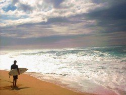
Ship Bottom, Long Beach Island
Ship Bottom is a borough in Ocean County, New Jersey, United Sates. The borough is situated on Long Beach Island and borders the Atlantic Ocean. It is also known as "The Gateway to Long Beach Island".
Home > BOARD SPORTS > Surfing > Klamath Rivermouth, Crescent City
Because of the changing ocean, the spot represents a photographer’s dream shooting. The birds are passing by and the strong waves are forming a different beach landscape every day by moving the sand. It has one of the most intriguing water systems, so many times it washes up various artifacts from the bottom of the sea.
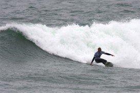
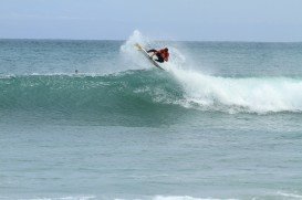
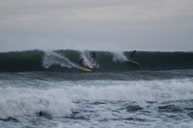
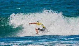
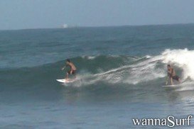
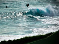
Due to its powerful waves, the spot is a surfer’s dream destination. The wave quality is regional classic and the frequency is regular. It doesn’t require any special experience to surf on that beach. Type of the wave is river mouth and the direction is right.
The bottom of the sea is sandy. Power of the wave is fun and its normal length is 164 to 492 ft/50 to 150 m. On good days length is long from 492 to 800 ft/150 to 300 m. Good swell direction is west, southwest and south and best wind direction is east. The swell size starts at less than 1 m / 3 ft and holds up to 2.5 m+ / 8 ft+.
Best tide position is all tides. One of the greatest dangers is sharks, especially in autumn when salmons run. It’s a dangerous beach, but it promises good barrels to the brave ones.
Ship Bottom is a borough in Ocean County, New Jersey, United Sates. The borough is situated on Long Beach Island and borders the Atlantic Ocean. It is also known as "The Gateway to Long Beach Island".
East Sussex is located in the south of England. The county enchants visitors with its scenic coastline, historic towns, and unspoilt landscapes. But that is not all, East Sussex also provides a great number of recreational activities for visitors and locals alike.
Marion Bay is on the doorstep to some of the best beaches in Australia that host a rich maritime history. Marion Bay is located in Yorke Peninsula, South Australia.
Ditch Plains is a well-known beach in Montauk, New York. Just like Montauk, Dich Plains is favored with great amenities for your entertainment and relaxation.
Puerto Rico is situated in the northeastern Caribbean and consists of an archipelago that includes the main island of Puerto Rico and a number of smaller islands. The climate here is classified as a tropical marine climate, with an average temperature of 82.4°F/ 28°C, throughout the year. Although it is a small island, the smallest island of the Greater Antilles, Puerto Rico provides superb natural surroundings, countless adventure experiences and many places of historical interest.
Puerto Rico is situated in the northeastern Caribbean and consists of an archipelago that includes the main island of Puerto Rico and a number of smaller islands. The climate here is classified as tropical marine climate, with an average temperature of 82.4°F/ 28°C, throughout the year. Although it is a small island, the smallest island of the Greater Antilles, Puerto Rico provides superb natural surroundings, countless adventure experiences and many places of historical interest.
Crescent South Beach is located near Crescent City, Del Norte County, California, USA.
Big Lagoon is located at 7 mi/11.3 km north of Trinidad, Humboldt County, California, USA.
Crescent South Beach is located near Crescent City, Del Norte County, California, USA.
Mount Shasta is located in northern California, east of Interstate 5 along SR89, between Mount Shasta city and McCloud city, California, USA.
Wilson Creek Beach is located near Klamath, Del Norte County, California, USA.